Best Hikes at Mount Rainier (and Why We Like Them)
With over 250 miles of hiking trails featuring waterfalls, forests, rivers, and of course, incredible mountain views, visiting Mount Rainier National Park should be on every hiker’s bucket list.
Disclosure: We’ve included affiliate links with recommended hiking gear in this post. If you click through and buy something, we’ll receive a small portion of that sale. You won’t be charged more, and we haven’t been paid by any of these retailers to share their information. These are all our genuine preferences.
When to hike at Mount Rainier
Most of these hikes are accessible between July and October but we’ll share specific information on accessibility for each trail recommended. The hiking season is rather short here because there is snow on the mountain between November and June. With snow comes dangers, including avalanches in the winter months and post-holing into rivers during spring, so take the recommendations of when to hike each trail seriously.

Skyline Trail
How to choose a hike
Mount Rainier is a large park, with great distances between visitor centers and many of these hikes mentioned. Check out our suggested itinerary to plan your trip and hikes or check these off one by one.
If it’s your first-time hiking, choose a trail rated easy to moderate and keep it under four miles or so. Check out our packing list to ensure you have everything you need to stay safe.

Tolmie Peak
Parking passes
Trails within and around Mount Rainier National Park will require one of three parking passes, with each hike listed below specifying what is required.
At $80, the America the Beautiful Pass is the best and most expensive option. It covers all national parks and Washington’s national forests for a year based on the time of purchase.
A second option would be to purchase a Mount Rainier National Pass. Standard entrance passes are $30 and good for seven days. This pass covers all hikes within the national park, but not the hikes in the surrounding national forests.
Lastly, you can opt to purchase a National Forest Pass for $30 for an annual pass or $5 for a day pass. This pass is only good for national forests, so you wouldn’t be able to hike within Mount Rainier National Park. Most of the hike recommendations in this blog are within the national park, so choosing this pass would greatly limit where you could hike.

Timed entry reservations
Starting in 2024, Mount Rainier National Park is piloting a timed entry reservation system to access the Paradise and Sunrise Corridors. We explain all the details in this blog but keep in mind that you can access these trails before and after the regulated hours as well.
To help plan your trip, we’ve listed these hikes’ general locations and we’ve added information on the corridors for each as well.
Most popular
Fremont Lookout
Trail description: Washington Trails/Alltrails
Distance: 5.6 miles
Elevation gain: 1,200 feet
Season: June to September
Parking Pass needed: Mount Rainier Entrance Fee or an America the Beautiful Pass
Area of the park: Sunrise Visitor Center — in the Sunrise Corridor
Fremont Lookout is a fan favorite for good reason. The hike has great views of Mount Rainier along the whole trail, it’s not too hard, and you get to check out a historic fire lookout. This is a great one to do at sunrise or sunset, but don’t expect to have solitude. It’s also a great spot to watch the stars and climbers summiting Rainier on a clear night.
If you want similar views with fewer people and don’t mind a longer hike, head to nearby Skyscraper Mountain at the junction in the trail.
Best wildflower meadows
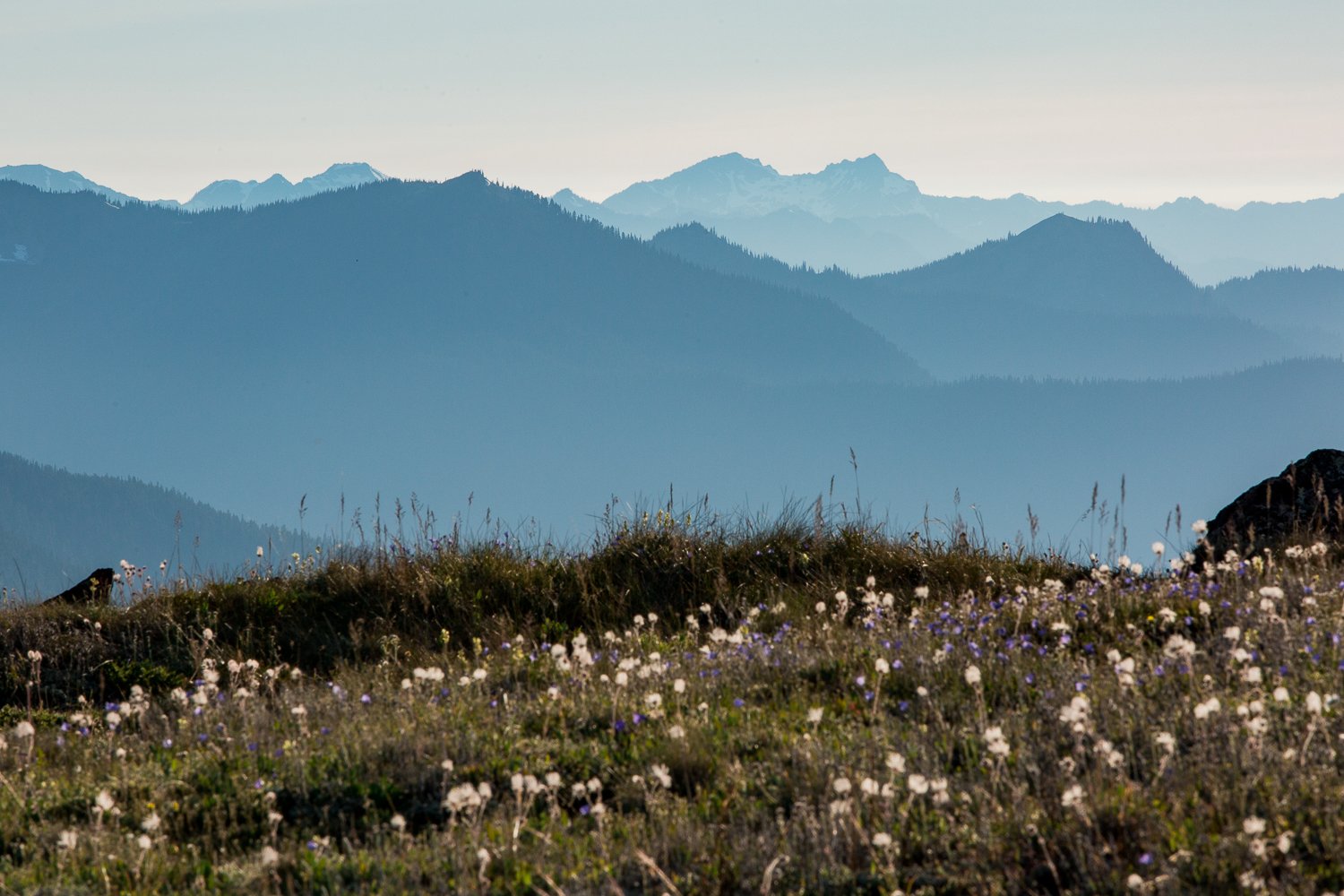
Skyline Trail
Trail description: Washington Trails/Alltrails
Distance: 5.5 miles
Elevation gain: 1,450 feet
Season: June to September
Parking Pass needed: Mount Rainier Entrance Fee or an America the Beautiful Pass
Area of the park: Paradise Visitor Center — in the Paradise Corridor
Since there are many intersecting trails at Paradise, it’s best to start your trip here with a stop at the visitor center to purchase a map. Hike this loop counterclockwise for the best views and be sure to stop by Myrtle Falls.
If you’ll be hiking early in the season, there will likely be snow at the top of the hike. Check recent trip reports to assess whether you’ll need microspikes or not.
Great shorter alternatives are the Golden Gate trail, the Nisqually Vista Trail or the Glacier Vista Loop.

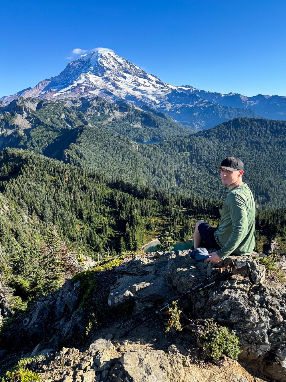
Closest views of Rainier (without climbing it!)
Third Burroughs
Trail description: Washington Trails/Alltrails
Distance: 9 miles
Elevation gain: 2,500 feet
Season: June to September
Parking Pass needed: Mount Rainier Entrance Fee or an America the Beautiful Pass
Area of the park: Sunrise Visitor Center — in the Sunrise Corridor
This trail is completely exposed, so it’s best to start this hike early in the morning. You’ll hike over rolling hills, a snowfield (microspikes are needed in the early season), and once you get to Third Burroughs, you’ll be close enough to the mountain to see the Winthrop Glacier.
Make it a longer loop (and pass fewer people on your way back) by taking the Burroughs Mountain Trail/Wonderland Trail back to the Sunrise Visitor Center, which adds a little over a mile.

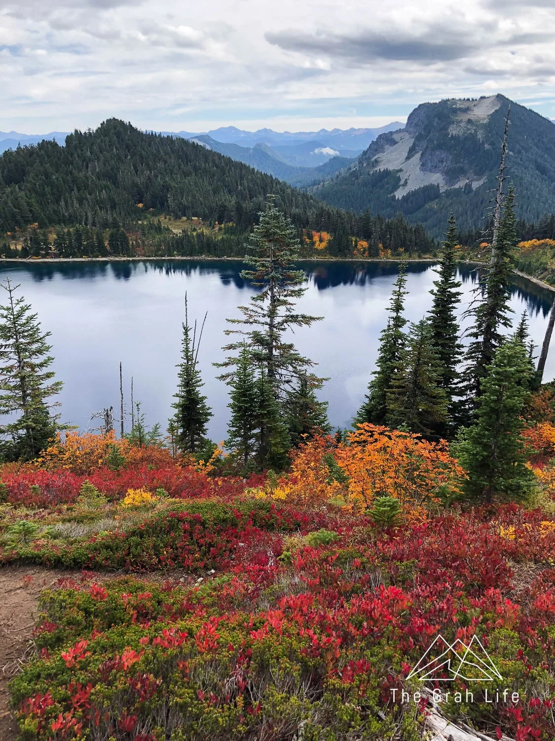
Best fire lookout
Tolmie Peak
Due to the closure of the Carbon River Fairfax Bridge, Tolmie Peak is only accessible via the Wonderland Trail by permit only.
Trail description: Washington Trails/Alltrails
Distance: 7.5 miles
Elevation gain: 1,100 feet
Season: June to September
Parking Pass needed: National Forest Pass or an America the Beautiful Pass
Area of the park: Carbon River — not in a timed entry corridor
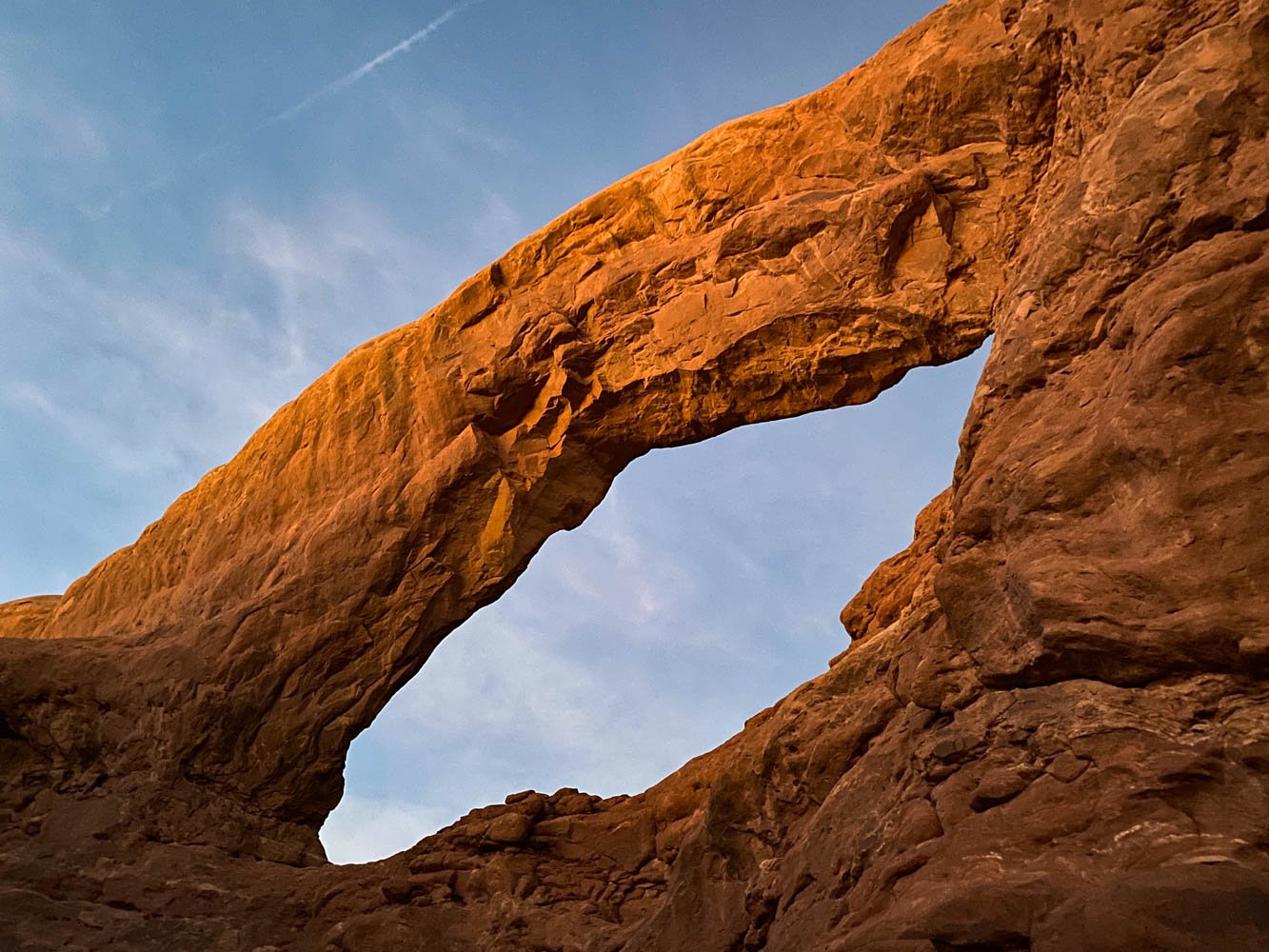
Hike here and you’ll have a bit of everything: forest, a lake, a historic fire lookout, and panoramic views. I love that once you’re at the fire lookout, you have the whole ridge to explore – it helps spread everyone out. Hike here at sunrise or sunset for alpenglow like below.
As of 2024, there is a new weight limit on the Carbon River/Fairfax Bridge of 8 tons, or 16,000 pounds. Crossing this bridge is necessary to reach the trailhead to Tolmie Peak. Mid-size SUVs will likely be under the limit but please check the weight of pickups and RVs before driving here.

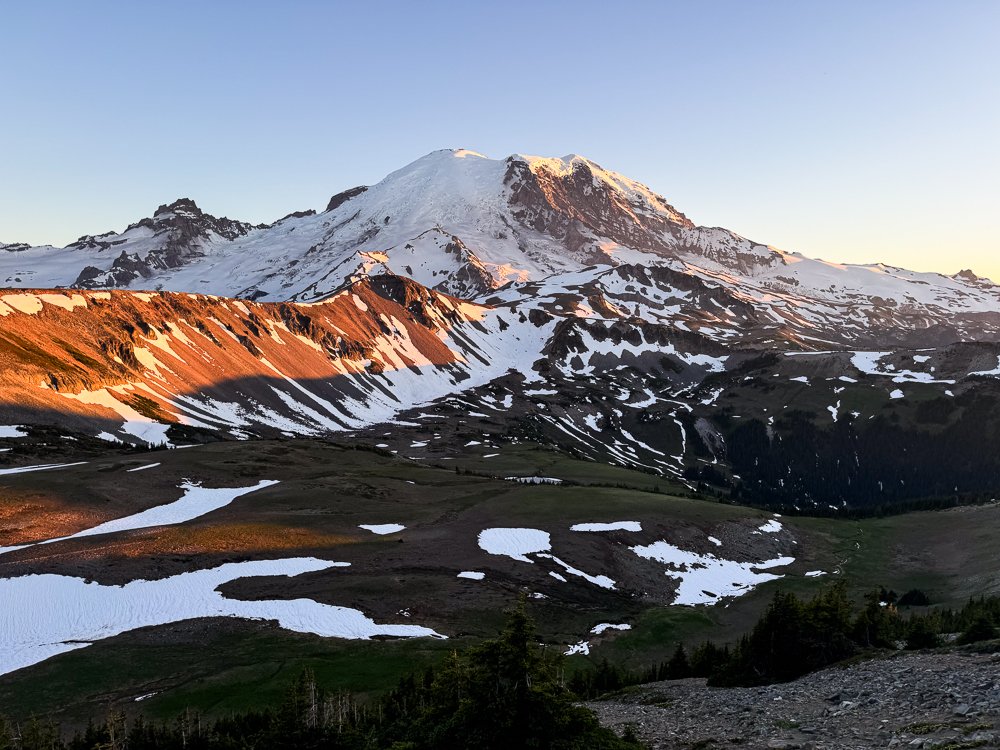
Best sunrise
High Rock
Trail description: Washington Trails/Alltrails
Distance: 3.2 miles
Elevation gain: 1,365 feet
Season: June to October
Parking Pass needed: None
Area of the park: Longmire — not in a timed entry corridor
Short, steep, and beautiful! This hike is perfect to watch the sunrise from, although we don’t recommend it for sunset. The trail back down can be hard to find (no problems following the trail going up).
At the top of this hike, you’ll have views of the valley below Mount Rainier from a cliff that sits 600 feet above the surrounding landscape. Expect wind, but if you’re lucky the lookout at the top will be unlocked!

Best waterfall
Comet Falls
Trail description: Washington Trails/Alltrails
Distance: 3.8 miles
Elevation gain: 1,200 feet
Season: June to September
Parking Pass needed: Mount Rainier Entrance Fee or an America the Beautiful Pass
Area of the park: Paradise — in the Paradise Corridor
This trail follows a river and is beautiful the whole way. It’s Zach’s favorite hike in Washington, and we love it because you can walk up to the falls and get soaked by the mist — perfect for a hot summer day. If you’re up for more, head to Van Trump Park and you’ll find wild blueberries and a meadow with views of Mount Rainier at the top.
Snoquera Falls gets an honorable mention here as well. It’s a seasonal waterfall, so it’s best in early late spring or early fall.

Best easy trail
Nisqually Vista
Trail description: Washington Trails/Alltrails
Distance: 1.1 miles
Elevation gain: 200 feet
Season: June to September
Parking Pass needed: Mount Rainier Entrance Fee or an America the Beautiful Pass
Area of the park: Paradise Visitor Center — in the Paradise Corridor
Right off the Paradise Visitor Center, this trail is ADA-accessible, relatively flat (small rolling hills), and paved the whole way. You’ll pass by fields of wildflowers — peak bloom time is usually August and a great overlook with views of Mount Rainier and the Nisqually Glacier from afar. It’s also an easy snowshoe between November and March.
Best scramble
Plummer Peak
Trail description: Washington Trails/Alltrails
Distance: 3.1 miles
Elevation gain: 1440 feet
Season: Late June to September
Parking Pass needed: Mount Rainier Entrance Fee or an America the Beautiful Pass
Area of the park: Paradise Visitor Center — in the Paradise Corridor
If you’re uncomfortable with a class III scramble, turn around at Pinnacle Saddle on this hike. If you’re game for a bit of climbing and a lot of route finding, from the saddle, continue to the north to make your way to Plummer Peak. All the while you’ll have vast views of Mount Rainier!

Best river views
Silver Falls Loop
Trail description: Washington Trails/Alltrails
Distance: 3 miles
Elevation gain: 600 feet
Season: June to September
Parking Pass needed: Mount Rainier Entrance Fee or an America the Beautiful Pass
Area of the park: Stevens Canyon — not in a corridor
This is a great easy loop to do on your way to or from Packwood into the park. You’ll get glimpses of the bright blue river along the trail, and you’ll have reached the middle of the loop when you reach a bridge and view of Silver Falls.

Best forest hike
Grove of Patriarchs
Trail description: Washington Trails/Alltrails
Distance: 1.5 miles
Elevation gain: 50 feet
Season: June to September
Parking Pass needed: Mount Rainier Entrance Fee or an America the Beautiful Pass
Area of the park: Stevens Canyon — not in a corridor
Flooding has closed this trail for now, but when it reopens, it’s a beautiful boardwalk trail through old-growth forests. Some trees here are over 1,000 years old and 25 to 50 feet around — as wide as Redwood trees!
Best lakes
Palisades Lakes
Trail description: Washington Trails/Alltrails
Distance: 7 miles
Elevation gain: 1,800 feet
Season: June to September
Parking Pass needed: Mount Rainier Entrance Fee or an America the Beautiful Pass
Area of the park: Sunrise Visitor Center — in the Sunrise Corridor
Hike here for not one or two, but three lakes. The last one — Upper Palisades Lake is the most scenic. This hike is less popular than many at Sunrise, so watch for wildlife.
For shorter, but still incredibly beautiful lake hikes at Rainier, try Bench and Snow Lakes or the Emmons Moraine Trail.
Loneliest trail
Shriner Peak
Trail description: Washington Trails/Alltrails
Distance: 8.5 miles
Elevation gain: 3,434 feet
Season: June to September
Parking Pass needed: Mount Rainier Entrance Fee or an America the Beautiful Pass
Area of the park: Chinook Pass — not in a corridor
If you’re looking for solitude, this is your hike. Just as Washington Trails says, Shriner Peak is one of Washington’s least-trafficked hikes near Rainier. It’s a beautiful trail with wildflowers, a fire lookout, and a great view of Rainier.
Why isn’t it more popular? It’s a tough, long, and exposed trail. Go early, or on an overcast day, to prevent heat exhaustion.

Longest day hike
Spray Park Loop
Due to the closure of the Carbon River Fairfax Bridge, Spray Park is only accessible via the Wonderland Trail by permit only.
Trail description: Washington Trails/Alltrails
Distance: 16 miles
Elevation gain: 5,100 feet
Season: June to September
Parking Pass needed: Mount Rainier Entrance Fee or an America the Beautiful Pass
Area of the park: Carbon River — not in a corridor
This is the best, longer day hike we’ve found. It gives you a bit of everything — wildflower meadows, waterfalls, and great views.
Worst bugs
Naches Peak Loop
Trail description: Washington Trails/Alltrails
Distance: 3.2 miles
Elevation gain: 600 feet
Season: June to September
Parking Pass needed: Mount Rainier Entrance Fee or an America the Beautiful Pass
Area of park: Chinook Pass — not in a corridor
Not the award we wanted to give, but it’s information that should be shared. Never have we thoroughly enjoyed ourselves hiking here. It’s beautiful, yes, but you’ll likely be eaten alive. Come with clothing treated with permethrin, some bug bands, and our favorite bug spray to stand a chance.

Best fall colors
Summit lake
Due to the closure of the Carbon River Fairfax Bridge, Summit Lake is only accessible via the Wonderland Trail by permit only. Hike the Skyline Trail or Naches Peak Loop as a great alternatives for fall colors.
Trail description: Washington Trails/Alltrails
Distance: 6.1 miles
Elevation gain: 1,300 feet
Season: May to October
Parking Pass needed: Northwest Forest Pass or an America the Beautiful Pass
Area of the park: Carbon River — not in a corridor
Drivers beware, this forest road is rough! It’s full of shale and warrants a high-clearance vehicle. If you can manage it, the fall colors are gorgeous surrounding the lake. Head up to the Summit Lake Peak for great views of Rainier.
This is the only trail on this list that dogs are allowed (on leash)!
Best snowshoe
Reflection Lakes
Trail description: Washington Trails/Alltrails
Distance: 7 miles
Elevation gain: 560 feet
Season: November to March
Parking Pass needed: Mount Rainier Entrance Fee or an America the Beautiful Pass
Area of the park: Paradise Visitor Center — no timed entry needed in the off-peak season
We love this snowshoe because it’s safe from avalanche dangers — just make sure you follow the signs to Reflection Lake, staying to the left when the trail forks.
Rent snowshoes from Whittaker Mountaineering or the National Park Inn General Store at Longmire (although those tend to sell out).
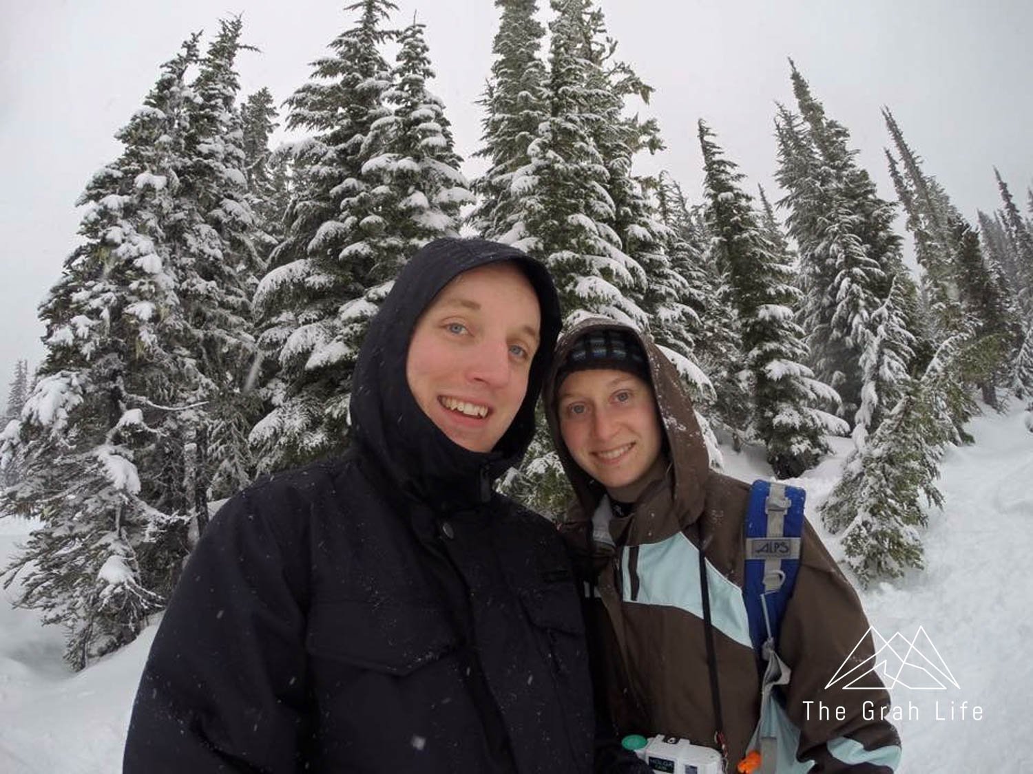
Our first ever snowshoe in 2018

Back again in 2025
Leave no trace
Mount Rainier has a highly sensitive ecosystem. It’s especially important to follow the Leave No Trace Principles in such a well-trafficked area. The wildflower meadows are especially at risk. Please stay on designated trails to prevent trampling the flowers — they only have a few months to grow every year! If you’d like photos that look like you’re amidst the fields of flowers, get creative with your angles.

What to pack for your hike
If you’re wondering what you should pack for a hike, check this list. It has all our favorite hiking gear, with recommendations on what to look for when shopping for yourself.
Top tips
Check out all of our park tips — like when to enter the park without backups and more here.


Search the blog for more adventures! Try searching for topics such as “camping”, “waterfalls”, or “Washington”.