Waterfall Tour on the North Umpqua Scenic Byway
The North Umpqua Scenic Byway is our favorite highway in Oregon. It follows the stunning Rogue River between Roseburg and the start of the Crater Lake North Highway, making it the perfect route to travel to or from the Oregon coast. Along the way, you can stop at seven easy-to-reach waterfalls.
Know what you’re searching for? Click on a link below to jump to a section.
North Umpqua Scenic Byway waterfall tour
North Umpqua Scenic Byway waterfall tour
While driving the North Umpqua Scenic Byway you’ll pass by numerous waterfalls. Some require short hikes, while others are short distances off the highway. We’ll share the waterfalls in order going west to east, but it’s just as scenic traveling in either direction. These sights are best visited between May and October.
Stop at any, or all the sights as you see fit. If you’re short on time, stop at Whitehorse and Clearwater Falls for quick, great waterfalls.
Mileage: 90 miles
Drive time: 1.5 hours
Waterfalls and scenic stops
Swiftwater Park
Hop out of the car here to get a closer look at the North Umpqua River. The viewing platform is paved and ADA friendly.
Susan Creek
Trail description: Alltrails/Oregon Hikers
Distance: 1.5 miles
Elevation gain: 187 feet
Parking Pass needed: None
Susan Falls is a 60-foot waterfall with a single drop. The hike here is short and easy with minimal elevation gain. Visit to see how the forest is recovering after the 2020 Archie Creek Fire, and beware of poison oak in the area.
Soda Springs Trailhead
Although we don’t recommend hiking here, there are great views from the Soda Springs Trailhead. Stop to see more basalt columns towering over the river.
Fall Creek Falls
Trail description: Alltrails/Hike Oregon
Distance: 1 mile
Elevation gain: 288 feet
Parking Pass needed: None
You’re rewarded with multiple viewpoints for this three-tiered falls. The bottom tier is our favorite because you can walk right up to the edge of the water.
Toketee Falls
Trail description: Alltrails/Oregon Hikers
Distance: 0.8 mile
Elevation gain: 170 feet
Parking Pass needed: None
This is the largest waterfall along the scenic byway. The two-tiered falls drops from impressively tall basalt columns into an icy blue pool.

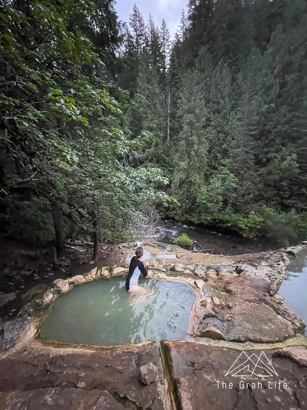
Umpqua Hot Springs
Trail description: Alltrails/Soak Oregon
Distance: 0.6 mile
Elevation gain: 147 feet
Parking Pass needed: Northwest Forest Pass or the America the Beautiful Pass
Stop here for a soak in a natural hot spring! It’s very popular, so if you’d like to have a peaceful experience, we highly recommend visiting at sunrise on a weekday.
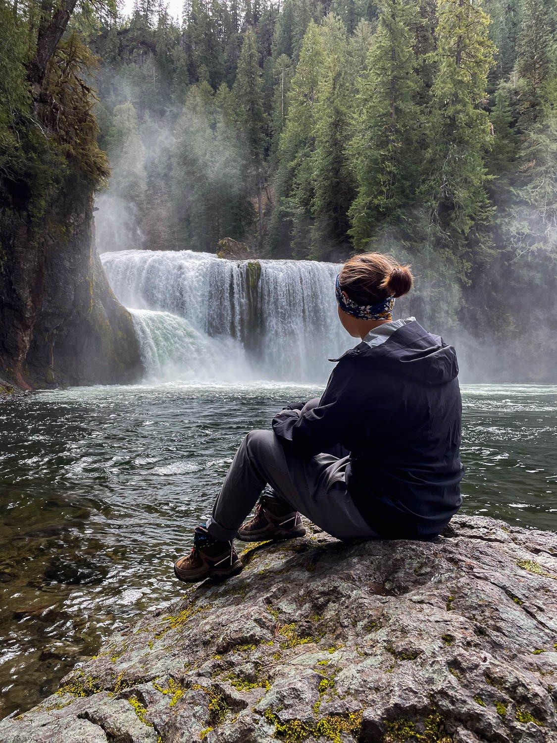
Watson Falls
Trail description: Alltrails/Hike Oregon
Distance: 0.8 mile
Elevation gain: 433 feet
Parking Pass needed: None
Watson Falls is an impressive 294-foot waterfall with a single drop. There are two viewpoints along the trail. You’ll reach the lower viewpoint first where you’ll have a great view of the entire falls, with the upper viewpoint up the trail another 0.25 miles.
Whitehorse Falls
Trail description: Alltrails
Distance: 0.1 mile
Elevation gain: 3 feet
Parking Pass needed: None
Whitehorse Falls is located just off the parking lot. There is a great viewing platform, making this waterfall very ADA friendly. This one was a favorite of ours!

Clearwater Falls
Trail description: Alltrails
Distance: 0.2 mile
Elevation gain: 32 feet
Parking Pass needed: None
Clearwater Falls is a must stop. The falls is wide, cascading around moss, lush plants, and logs, with the clearest water you’ll ever see. It’s all viewable from an ADA-accessible platform.

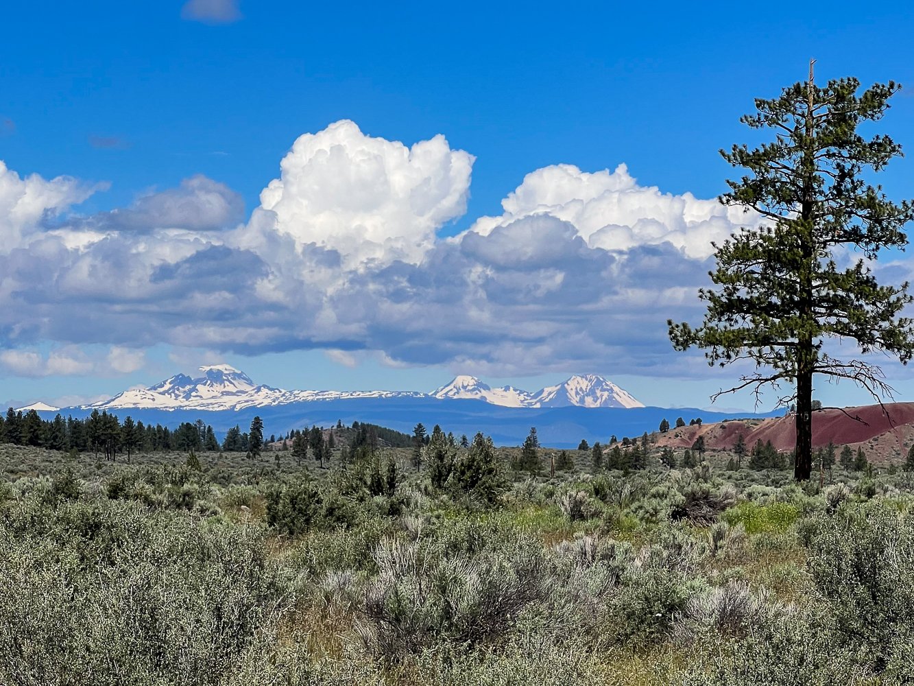
Diamond Lake
Stop by Diamond Lake and the Diamond Lake Overlook for great views. On a clear day you’ll see the bright blue lake, Mt Bailey behind it, and Mt Thielsen in the opposite direction.
National Creek Falls
Trail description: Alltrails/Oregon Hikers
Distance: 0.8 mile
Elevation gain: 150 feet
Parking Pass needed: None
If you’re headed to Prospect (we suggest staying here if you’re visiting Crater Lake), this hike is along the way, although it’s off the W Diamond Lake Highway, not the North Umpqua Scenic Byway. It’s by far the steepest hike on this list, but you can also expect to have this trail to yourself. The waterfall is visible if you peek around a rock (where you’ll promptly get a blast of mist to your face).

Is the North Umpqua Highway waterfall tour pet-friendly?
All the trails are pet-friendly, but please follow B.A.R.K rules.
B: Bag poop
A: Always wear a leash
R: Respect wildlife
K: Know where to go
Where to stay
Although this is a great drive from the Oregon coast inland to Crater Lake, or Bend, it’s also a great destination.
Lodging
If you’d like a central place to stay along the highway, we highly recommend staying at the Steamboat Inn. It’s an unplugged destination offering pet-friendly cabins that sleep up to six. Onsite is a seasonal restaurant with fine dining — reservations are requested.
You’ll find Umquah’s Last Resort ten minutes down the road. They have various types of lodging that sleep between two and ten guests, as well as tent and large RV sites with full hookups.
Book lodging at the Historic Prospect Hotel if you’re on your way to Crater Lake National Park. There are more waterfalls in town, and this is the closest lodging you can book outside of the park.

Camping
There are campgrounds all along the North Umpqua Highway. These are our favorites.
Island Campground
This is a shady, small campground, on the banks of the North Umpqua River. Sites are smaller, and there is no drinking water or garbage disposal here. Please pack out all your waste.
Amenities:
Pet friendly
Grey water waste sump
RV and trailer length: 24 feet
Accepts reservations: No
First-come, first-served campsites: Yes
Number of sites: 7
Typically open: Year round
Horseshoe Bend Campground
Horseshoe Bend Campground is located on the North Umpqua River in a prime location for fly fishing, wading, and easy access to hiking and mountain biking.
Amenities:
Pet friendly
Accessible campsites
RV and trailer length: 35 feet
Accepts reservations: Up to six months in advance
First-come, first-served campsites: Yes
Number of sites: 25
Typically open: August to September
Toketee Lake Campground
There is no drinking water at Toketee Lake Campground, but you do have great access to Watson and Toketee Falls within a five-minute drive and lake access. The lake is two to three feet lower than the boat ramp, so small non-powered boats are best here.
Amenities:
Pet friendly
Boat ramp
Accessible sites
RV and trailer length: 24 feet
Accepts reservations: Two days in advance
First-come, first-served campsites: Yes
Number of sites: 33
Typically open: Year round
Diamond Lake Campground
This is the largest campground in the area. Some sites are along the edge of the lake and others are amongst the forest. The downside is that it can get buggy during the summer months.
Amenities:
Pet friendly
Showers
General Store
Boat rentals
Two boat ramps
Moorage
Grey water waste sumps
RV dump station
Accessible campsites
RV and trailer length: 35 feet
Accepts reservations: Up to six months in advance
First-come, first-served campsites: Yes
Number of sites: 238
Typically open: August to September
What to pack
Check out our Pacific Northwest packing list here. In short, you’ll want to wear quick dry clothing, bring a rain jacket, mid layer, and hiking boots. Even if you’re not considering hiking much, at the very least bring a pair of closed toed shoes with good tread. Trails tend to be muddy and rocky here.
Want to know what else we bring hiking? Check out our gear list here.
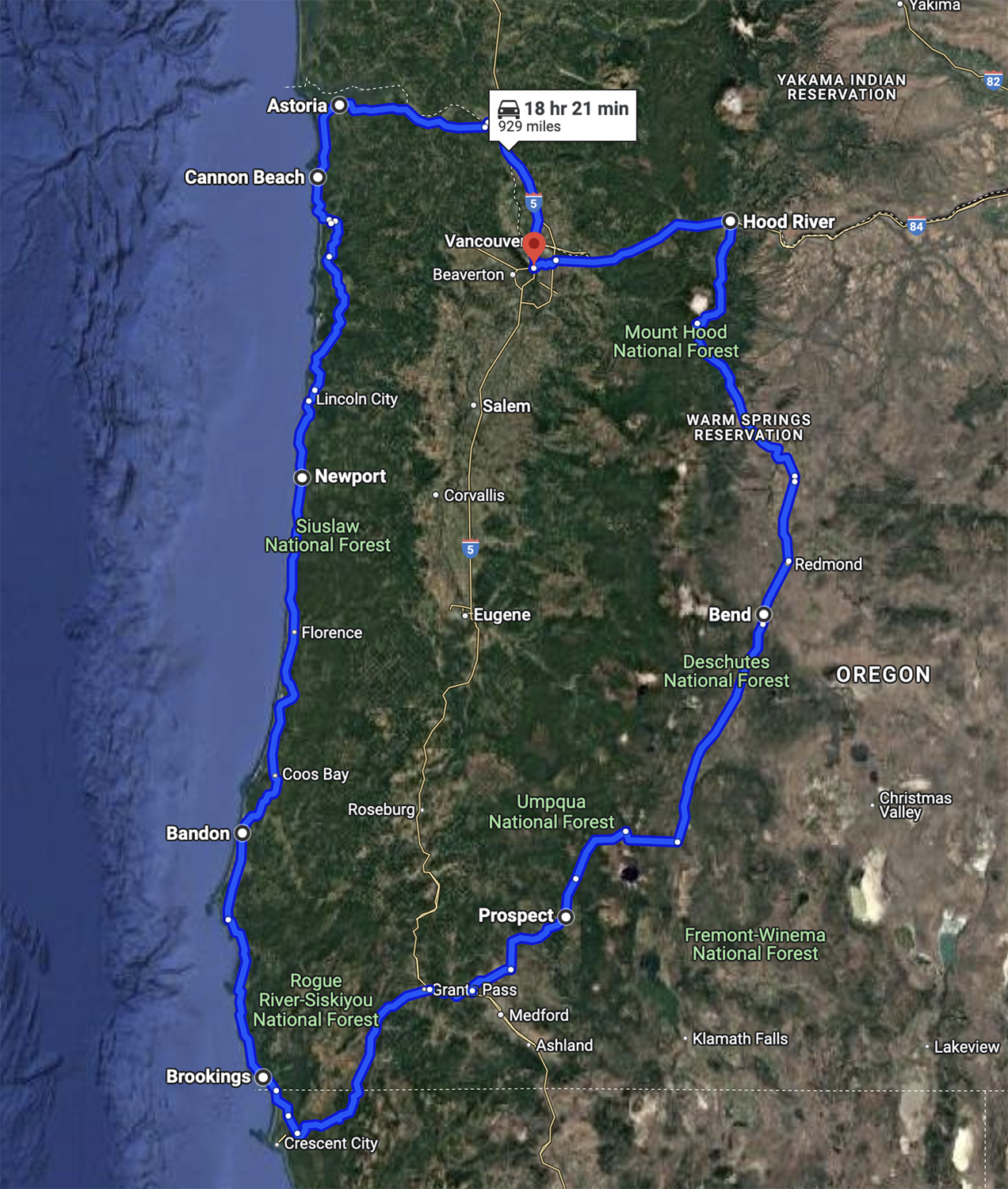
Where to go next
The Ultimate Oregon Road Trip
Check out this route and itinerary to see all of Oregon’s best sights! It includes the Oregon coast, Crater Lake, Bend, the Columbia River Gorge and Portland.
Crater Lake National Park
Located on the east side of the North Umpqua Scenic Byway, stopping at Crater Lake is a must if you’re in the area between mid-July and September. Check out our park itinerary with more activity suggestions here.

Oregon Coast
Roseburg, the western most point on the North Umpqua Scenic Byway, is about an hour and a half drive from the Oregon Coast. Check out this blog to see all the best sights there.

Scottsburg County Park along the Umpqua River near Reedsport
Bend
Bend is Oregon’s most outdoorsy town, full of activities like rock climbing, paddling, and hiking. It’s an hour and forty-minute drive from the North Umpqua Scenic Byway.


Search the blog for more adventures! Try searching for topics such as “backpacking”, “waterfalls”, or “national parks”.