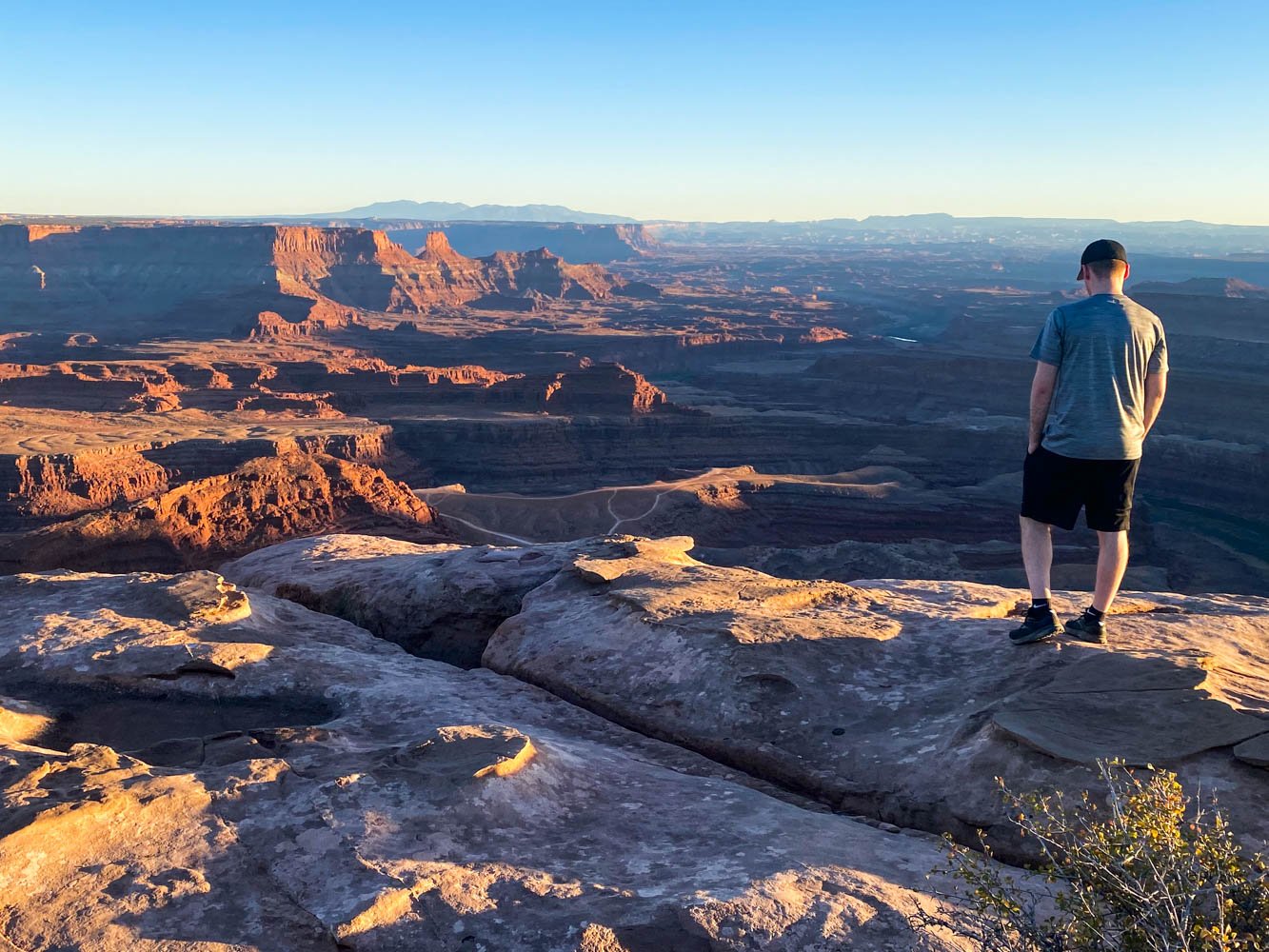
Best Hikes in Moab, Utah (30+ Stunning Trails)
If you’re visiting Moab, hiking should be on the list of must-do's. There is a trail here for everyone, with varying landscapes that include streams, waterfalls, canyons, and the most incredible natural rock arches and formations.
Know what you’re searching for? Click on a link below to skip to a section.
Hikes recommendations in:
Canyonlands National Park:
Seasonal Warnings
You’ll find more information on when to visit and the weather here, but in general, spring and fall are the best times to hike in Moab. The temperatures are more moderate with minimal rain, whereas the hot summer weather lends itself to water activities, such as whitewater rafting and less hiking.
In winter, the weather is unpredictable. You’ll need to be prepared for extreme, rapidly changing conditions while out exploring.
Regardless of the season, you’ll need to be aware of rain in the forecast and watch for flash flooding. Many of Moab’s roads are impassable after rain, and many hikes flood.
Parking passes
Canyonlands National Park, Arches National Park, and Dead Horse State Park all require parking passes. For Canyonlands and Arches, you can purchase a seven-day pass for $30 for each park or an America the Beautiful Pass for $80. The America the Beautiful Pass covers all national parks for one year from the purchase date, so this is the best purchase if you plan on visiting other national heritage sites, national parks, or other federal lands.
To visit Arches National Park, you’ll also need to purchase a timed entry reservation or enter the park before 7 a.m. or after 4 p.m. between April and October.
Dead Horse State Park has a daily pass for $20 entrance fee that includes up to eight people. Annual permits are available for $125. Purchases can be made in person, online, or via the Utah DNR State Parks app.
Recreating on National Forest and BLM Land does not require a parking pass.
Leave no trace
Please follow the Leave No Trace Principles while hiking in Moab. It’s important to stay on trails – stepping off the trail hurts the biological soil.
Do not climb, scramble, walk, stand, or rappel off any arch with an opening greater than three feet.
There are also petroglyphs and picture rocks located throughout the region. Do not scratch, alter, or touch them, and please leave what you find.
Hike recommendations
Arches National Park
Fiery Furnace
Hiking here is by permit or by ranger-led tours only. If you have a permit to hike it on your own, carry a map because it’s easy to get lost. It’s a physically demanding hike with irregular sandstone, loose sand, narrow ledges, drop-offs, and gaps that you must jump across.
Trail description: Alltrails
Distance: 2.1 miles roundtrip
Elevation gain: 492 feet
Season: Year-round
Parking Pass needed: Arches entrance fee or an America the Beautiful Pass
Dogs allowed on a leash: No
Delicate Arch
Delicate Arch is one of Arches National Park’s most popular hikes. It’s the perfect spot to watch the sunset from, although going for sunrise is a quieter experience. Give yourself extra time to find parking here – the lot is small.
Along the way, you’ll see the Wolfe Ranch at the start of the trail, with the option to take a ten-minute side trip to see the Ute Indian Petroglyphs on your way.
Trail description: Alltrails
Distance: 3.2 miles roundtrip
Elevation gain: 629 feet
Season: Year-round
Parking Pass needed: Arches entrance fee or an America the Beautiful Pass
Dogs allowed on a leash: No
Devil’s Garden
Although Delicate Arch is the most well-known arch in Arches National Park, Devil’s Garden is the best hike. It’s full of arches, spires, and narrow rock walls called fins. The area is exposed, with scrambles and climbs. Bring at least two liters of water per person, snacks, and sun protection (find more on what we pack hiking here).
The Devil’s Garden trail is a lollipop loop with optional side trails. Hike the entire eight-mile loop, and its spur trails, to see seven arches.
For a shorter hike, consider turning around at the Landscape Arch (two miles roundtrip), or Double O Arch for a four-mile hike. Adding the Navajo and Partition Arch Trails onto the route to Double O Arch adds 0.8 miles, while taking side trails to Pine Tree and Tunnel arches add 0.5 miles to either hike.
Trail description: Alltrails
Distance: 7.9 miles roundtrip
Elevation gain: 1085 feet
Season: Year-round
Parking Pass needed: Arches entrance fee or an America the Beautiful Pass
Dogs allowed on a leash: No
Double Arch
Double Arch is one of Arches National Park’s most impressive arch formations and one of the most easily accessible. From the parking area, it’s a quick walk to reach the 148-foot-wide pothole arch.
Trail description: Alltrails
Distance: 0.6 miles roundtrip
Elevation gain: 95 feet
Season: Year-round
Parking Pass needed: Arches entrance fee or an America the Beautiful Pass
Dogs allowed on a leash: No
Park Avenue
Wander here to walk between fins, pinnacles, and spires. You’ll have fantastic views of the Three Gossips, Courthouse Tower, and Tower of Babel. If you’d rather not hike the entire trail, turn around at the Park Ave Viewpoint not far into the trail. Bonus – this trail is shaded in the early morning.
Trail description: Alltrails
Distance: 1.8 miles roundtrip
Elevation gain: 298 feet
Season: Year-round
Parking Pass needed: Arches National Park Pass
Dogs allowed on a leash: No
Tower Arch
Reaching the Tower Arch trailhead requires driving 8 miles on the unpaved Salt Valley Road. In normal conditions, two-wheel-drive vehicles can drive here, but it is impassable in rain.
The hike is steep and strenuous, including climbing up slick rock and sand dunes. It’s primitive, without signage, so you’ll need to route find and bring an offline map.
Trail description: Alltrails
Distance: 2.4 miles roundtrip
Elevation gain: 600 feet
Season: Year-round
Parking Pass needed: Arches entrance fee or an America the Beautiful Pass
Dogs allowed on a leash: No
Windows and Turret Arch
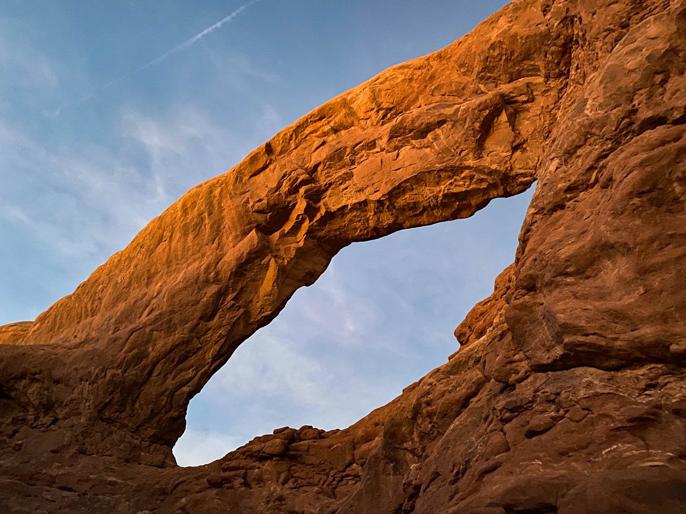
This hike can either be a 0.7-mile out and back or a 1.2-mile loop. The loop, which has cairns marking the lesser traveled trail, goes alongside the backside of the arches. It offers beautiful views of the La Sal Mountains, and more views of the arches without all the crowds.
Trail description: Alltrails
Distance: 1.2 miles roundtrip
Elevation gain: 154 feet
Season: Year-round
Parking Pass needed: Arches entrance fee or an America the Beautiful Pass
Dogs allowed on a leash: No
The backside of the trail
Sand Dune Arch
Get the best of Moab in one short trail – an arch, a sandy beach, and a slot canyon! Plus, it’s usually shaded, and you can combine this with Broken Arch to create a longer loop.
Trail description: Alltrails
Distance: 0.3 miles roundtrip
Elevation gain: 124 feet
Season: Year-round
Parking Pass needed: Arches entrance fee or an America the Beautiful Pass
Dogs allowed on a leash: No
Canyonlands National Park
The Island in the Sky District
The Islands in the Sky area of Canyonlands is the most popular area in Canyonlands. It has great scenic overlooks and shorter trails. Check out day two of our Moab itinerary to integrate them into your trip.
Mesa Arch
Mesa Arch is one of Utah’s most photographed arches. It spans an impressive 27 feet, framing the views of spires and the La Sal Mountains. Visit at sunrise for the most impactful experience.
Trail description: Alltrails
Distance: 0.7 miles roundtrip
Elevation gain: 88 feet
Season: Year-round
Parking Pass needed: Canyonlands entrance fee or an America the Beautiful Pass
Dogs allowed on a leash: No
Grand View Point
The Grand View Point is located at the southernmost end of the Island in the Sky scenic drive. The trail follows the canyon edge showcasing views of the White Rim Road, The Maze and The Needles. If you’re not up to hike the entire trail, there is a great viewpoint just off the parking lot.
Trail description: Alltrails
Distance: 1.8 miles roundtrip
Elevation gain: 164 feet
Season: Year-round
Parking Pass needed: Canyonlands entrance fee or an America the Beautiful Pass
Dogs allowed on a leash: No
White Rim Overlook
This is a great alternative trail to the Grand View Point trail. The views of the Monument Basin are similar and would make for a stunning sunrise hike.
Trail description: Alltrails
Distance: 1.8 miles roundtrip
Elevation gain: 160 feet
Season: Year-round
Parking Pass needed: Canyonlands entrance fee or an America the Beautiful Pass
Dogs allowed on a leash: No
Upheaval Dome
Upheaval Dome has two overlooks. The first is 0.3-miles into the trail. It’s short and steep, offering a clear view into the dome.
The second overlook is an additional 0.6 miles past the first overlook. It offers another viewing angle of the dome, but to reach it you’ll need route-finding skills.
Trail description: Alltrails
Distance: 1.2 miles roundtrip
Elevation gain: 226 feet
Season: Year-round
Parking Pass needed: Canyonlands entrance fee or an America the Beautiful Pass
Dogs allowed on a leash: No
Syncline Loop
Starting at the same trailhead as the trails to Upheaval Dome, the Syncline Loop circumnavigates the dome, although it does not provide views of the dome. Instead, you’ll see great rock formations and views into the valley below.
The Syncline Loop is the toughest trail in the Island in the Sky District, with steep switchbacks, scrambles, and route finding required.
Trail description: Alltrails
Distance: 7.9 miles roundtrip
Elevation gain: 1,601 feet
Season: Year-round
Parking Pass needed: Canyonlands entrance fee or an America the Beautiful Pass
Dogs allowed on a leash: No
The Needles District
Lost Canyon
Hike here for a variety of views – desert scrub, canyons, and park views. Flooding can wash out parts of the trail, so bring an offline map and be prepared to route find.
Trail description: Alltrails
Distance: 8.5 miles roundtrip
Elevation gain: 820 feet
Season: Year-round
Parking Pass needed: Canyonlands entrance fee or an America the Beautiful Pass
Dogs allowed on a leash: No
Chesler Park Loop
Start early – this is a long hike but it’s worth it! Route finding is required here, but if you can manage, you’ll be treated to short scrambles, a slot canyon, and great views of the Needles. Bring lots of water, too, because shade is sparse.
Trail description: Alltrails
Distance: 10.2 miles roundtrip
Elevation gain: 1,794 feet
Season: February to November
Parking Pass needed: Canyonlands entrance fee or an America the Beautiful Pass
Dogs allowed on a leash: No
Druid Arch
Most of the trail has you hiking through a riverbed, which is not very comfortable. However, Druid Arch is a stunning rock formation and there are great views along the way. Start early to have shade from the canyon.
Trail description: Alltrails
Distance: 9.7 miles roundtrip
Elevation gain: 1,446 feet
Season: Year-round
Parking Pass needed: Canyonlands entrance fee or an America the Beautiful Pass
Dogs allowed on a leash: No
Cave Spring Trail
This is more of a rock overhang than a cave, but it’s worth the stop because there are historical artifacts and sites along the way. Hiking the loop does require climbing up or down a couple of stationary ladders.
Please respect the area by following historical site etiquette, mentioned below.
Trail description: Alltrails
Distance: 0.6 miles roundtrip
Elevation gain: 59 feet
Season: Year-round
Parking Pass needed: Canyonlands entrance fee or an America the Beautiful Pass
Dogs allowed on a leash: No
Dead Horse State Park
East and West Rim Loop
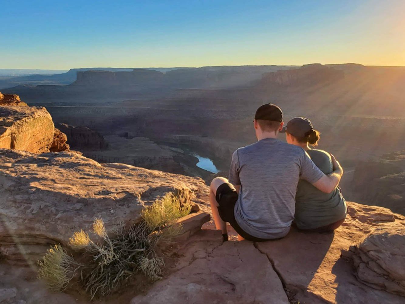
We particularly loved exploring this trail at sunset. You can hike the whole trail or stop at viewpoints in the park. Either way, you’ll get to see stunning views that go on for miles.
Trail description: Alltrails
Distance: 1.1 miles roundtrip
Elevation gain: 370 feet
Season: Year-round
Parking Pass needed: Dead Horse State Park
Dogs allowed on a leash: Yes
Peeping through a hole in the retaining wall
National Forest and BLM Land
Grandstaff
Hike here for views of beautifully water-sculpted sandstone and the Morning Glory Natural Bridge – the sixth-longest natural rock span in the United States! While hiking, be prepared for creek crossings and to do some light scrambling. Avoid the poison ivy growing under the bridge.
Trail description: Alltrails
Distance: 4.3 miles roundtrip
Elevation gain: 383 feet
Season: Year-round
Parking Pass needed: None
Dogs allowed on a leash: Yes
Corona and Bowtie Arch
Located on the Shafer Trail, this hike is worth braving the rough road. It does have a section with chains and a ladder, but the trail is well-marked. Add another arch to the hike by tacking on another mile to reach Pinto Arch.
Trail description: Alltrails
Distance: 1.3 miles roundtrip
Elevation gain: 462 feet
Season: Year-round
Parking Pass needed: None
Dogs allowed on a leash: Yes
Fisher Towers
If you’d like to get away from the crowds in the national parks, but still have awesome views, this is your hike. The trail weaves through red rocks and towering spires. Make your hike longer by creating a partial loop by taking the Red Onion Trail on your hike back.
Trail description: Alltrails
Distance: 4.2 miles roundtrip
Elevation gain: 1,469 feet
Season: Year-round
Parking Pass needed: None
Dogs allowed on a leash: Yes
Professor Creek and Mary Jane Canyon Trail
This trail is for Chaco lovers! Wear your good pair of hiking sandals and be prepared to walk through a shallow riverbed for this hike. You know you’ve reached the end when you’ve found the waterfall.
Trail description: Alltrails
Distance: 7.6 miles roundtrip
Elevation gain: 541 feet
Season: Year-round
Parking Pass needed: None
Dogs allowed on a leash: Yes
Mill Creek Trail
This is a great shorter alternative to the Professor Creek and Mary Jane Canyon Trail. Again, you’ll hike through the riverbed to reach a very cold pool with a waterfall at the end of the trail. The trail isn’t well marked, so bring a map.
Trail description: Alltrails
Distance: 1.6 miles roundtrip
Elevation gain: 59 feet
Season: Year-round
Parking Pass needed: None
Dogs allowed on a leash: Yes
Hunter Canyon Trail
Be warned – this trail is known to have mosquitoes! Come prepared, and you can enjoy a beautiful trail through the canyon offering diverse views.
Trail description: Alltrails
Distance: 3.7 miles roundtrip
Elevation gain: 387 feet
Season: Year-round
Parking Pass needed: None
Dogs allowed on a leash: Yes
Mill Canyon Dinosaur Bone Trail
A four-wheel drive vehicle is required to reach the trailhead, although it’s possible to park half a mile away and add the distance to your hike. Follow the trail’s informative signs to see fossilized trees and bones.
Trail description: Alltrails
Distance: 1.8 miles roundtrip
Elevation gain: 108 feet
Season: Year-round
Parking Pass needed: None
Dogs allowed on a leash: Yes
Aztec Butte Trail
Reaching the top of this hike requires a steep scramble. The views are awesome, but seeing the dwellings is the real prize here.
Please respect the area by following historical site etiquette, mentioned below.
Trail description: Alltrails
Distance: 1.6 miles roundtrip
Elevation gain: 249 feet
Season: Year-round
Parking Pass needed: None
Dogs allowed on a leash: No
Search the blog for more adventures! Try searching for topics such as “hiking”, “waterfalls”, or “Oregon”.


