How to Drive the Shafer Trail – Two Route Options
Tucked between Moab and Canyonlands National Park, the Shafer Trail is a must-drive for those craving adventure. It’s 19 miles of dirt road that requires a high clearance 4x4 vehicle, and it’s not for the faint of heart – steep switchbacks and narrow roads will have you on the edge of your seat!
We’re going over two route options – the traditional Shafer Trail and a second option with more advanced off-roading. If you want suggestions on fitting driving the Shafer Trail into your trip, check out our itinerary here.
Know what you’re looking for? Click on a button below to skip to a section.
When can you drive the Shafer Trail?
What kind of vehicle do you need?
What should you bring with you on the drive?
Where is the Shafer Trail?
The eastern start/end of the trail is located where the Potash Road intersects with U.S. Highway 191 at these coordinates: 38.605991, -109.602262.
The western start/end of the trail is located one mile north of the Canyonlands Visitor Center on the Grand View Point/Island in the Sky Road at these coordinates: 38.471524, -109.811501. You’ll find detailed maps below.
When can you drive the Shafer Trail?
The Shafer Trail is open to drivers year-round; however, it can close in the winter months due to snow. Do not drive here in wet conditions or if rain or snow is forecasted.
Check the weather forecast, road conditions, and trip reports on AllTrails before heading out.
What kind of vehicle do you need?
A high clearance vehicle 4WD is required to do this drive. Most AWD SUVs will do fine here, although Potash Road is very rough and puts a lot of wear on vehicles.
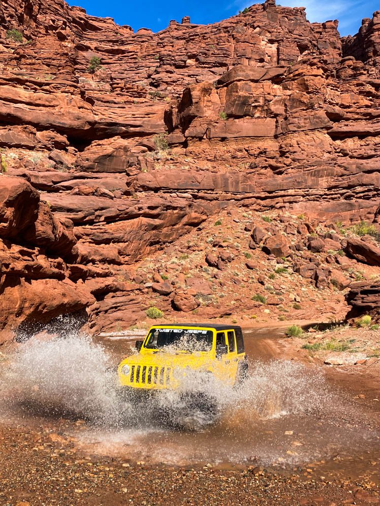
If you don’t have your own off-roading rig, we highly recommend renting from Twisted Jeeps. All their Jeeps are equipped for off-roading with aired-down tires, lift kits, trail armor, and more.
ATVs, OHVs, and UTVs are not permitted inside Canyonlands National Park.

What should you bring with you on the drive?
Like many national parks with limited restaurant options, we suggest bringing an ice chest for lunch and snacks. You’ll also want extra water, an emergency car kit, a spare tire, and sun protection. Cell service is extremely limited, and towing fees can cost upwards of $1,000, so be prepared to handle emergencies yourself.

Long Canyon
Shafer Trail rules
Speed limit of 15 mpg
Stay on trails
Going off trail disturbs the biological soil crust, and damaged soils are prone to erosion and invasive species
Uphill traffic (the vehicle facing uphill) has the right of way
Use berms and pullouts to allow traffic to pass safely
When caught needing to pass in difficult terrain, assess who passes based on who has the safest route
Please do not hold traffic up if a vehicle catches you – pull over to let others pass when safe
Follow leave No Trace Principles
Pack everything you bring in, out
Please respect petroglyphs and picture rocks
Do not scratch, alter, or touch them, and always leave what you find
No permits are needed to drive the Shafer Canyon Road or Potash Road
Drive statistics
Mileage: 35 miles
Drive time: 2 hours
The traditional Shafer Trail route
The Shafer Trail and Potash Road, also known as the Shafer Canyon Trail, can be driven in either direction. If you’re feeling timid about the Shafer switchback’s steep drop-offs, drive east to west. If you’re wanting a more thrilling ride, drive west to east, tackling the switchbacks first.
We’re covering each place you should stop along the way in this blog, from east to west.

Roadside petroglyphs
Stop here to view petroglyphs along the road. Once parked, look up — they’re 15 to 20 feet up the cliffside across the road.
Potash Road dinosaur tracks and petroglyphs
The Dinosaur Tracks Trail is a 0.2-mile easy hike. The largest tracks here were made by the three-toed Allosaurus!
Corona Arch
Start your drive early to hike this moderate 2.3-mile trail. It’s exposed and has a couple of sections with a chain and ladder. Taking the side trail to Pinto Arch will add another mile to your hike.
Elvis Rock
Set all the points of interest you’d like to stop in your GPS before you start your drive because you'll quickly love cell service on Shafer Road. The Elvis Rock is one of the easy-to-miss viewpoints. You’ll find it here, on the side of the road closest to the Potash Ponds.
Potash Ponds
You’ll drive by the Potash Ponds next. These are evaporation ponds from the Intrepid Potash, Inc. used to extract potassium chloride. The pools are a vibrant blue, contrasting beautifully against the red desert. The best views of them are from up above, higher on the road.

Thelma and Louise Point
The 1991 film “Thelma and Louise” is said to take place on a road trip from Arkansas to the Grand Canyon in Arizona. Much of the movie, including this final stunt, was filmed in Utah.
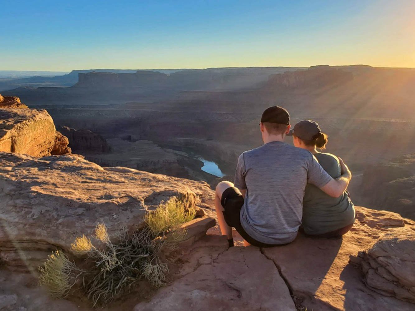
Gooseneck Overlook
The Gooseneck Overlook is like the Horseshoe Bend of Utah. Both river views feature the Colorado River, but the Gooseneck Overlook is much more remote.

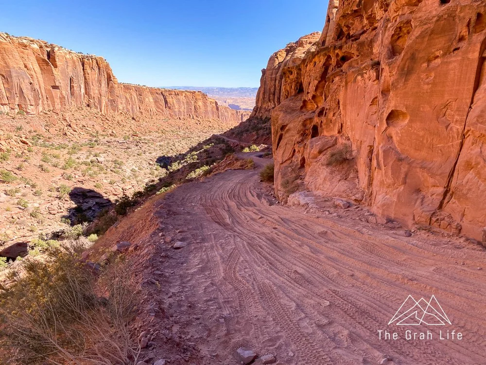
Shafer switchbacks
Here you’ll drive up 1,500 feet of elevation change on the cliffside leading to Canyonlands National Park. These switchbacks are the most impressive part of the drive. They’re steep, narrow, and have large drop-offs. If you have riders with a great fear of heights, have them sit in the back middle seat for the tamest ride.
The road here started as a route made by Native Americans to access the mesa top, then it became a trail for sheep herders, followed by a road for mining trucks, and finally into the backcountry road used for recreation today.

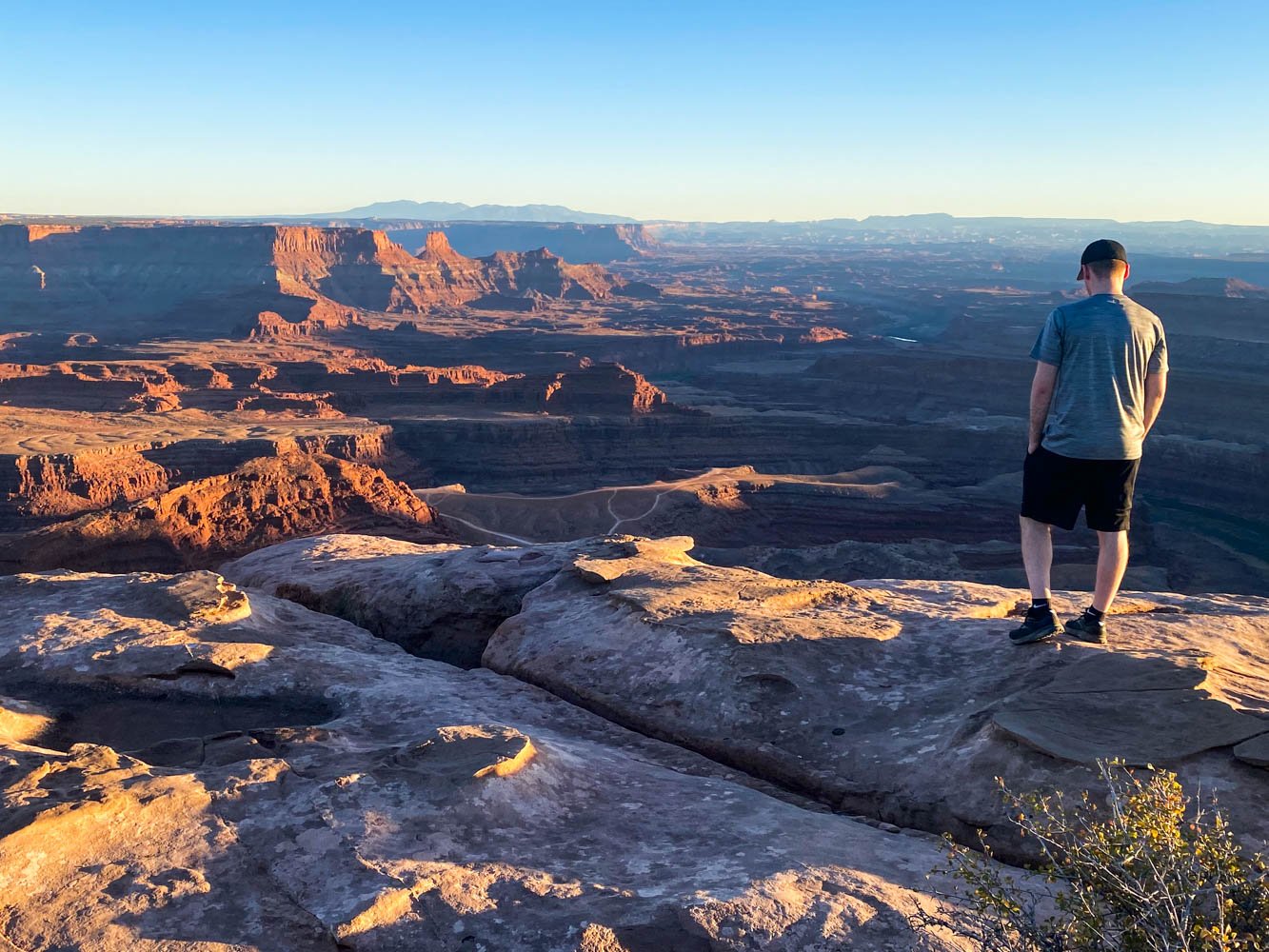
Shafer Overlook
This is the best spot to view the Shafer Trail switchbacks from above. This and the Shafer Trail Viewpoint is where all the iconic images looking down into the Shafer Trail are taken. If you’re driving the trail west to east, make this your last stop before going down the switchbacks.

The advanced off-roading Shafer Trail route
We got insider tips from Twisted Jeeps when they learned that we had Jeeps at home and were familiar with off-roading, so this route is truly a local gem. From Moab, you’ll crisscross the backcountry between Deadhorse State Park and town to reach the Shafer Trail into Canyonlands.
Do not drive here in wet conditions or if rain or snow is forecasted. Previous off-roading experience is advised but not required.

Gemini Bridges
Your drive starts at the Gemini Bridges Trailhead here. From Highway 191, you’re going to overland to the Gemini Bridges, which are 200-foot twin arches. The top of the arch is wide and safe to walk on, so hop out of the car and explore the area after you arrive.

Long Canyon
From Gemini Bridges, you’ll connect with Highway 313 and drive south to Long Canyon Road. Apart from the Shafer Trail, this was our favorite drive in Moab.
Long Canyon has large, steep walls, with a turn halfway down, so there aren’t clear views to the bottom. Running into oncoming traffic here would be sudden and mean one driver having to back up long distances to let others pass. There are also sections with steep drop-offs and soft, powdery dirt about 4-6 inches deep.
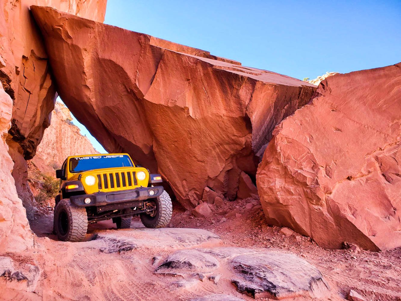
Rocky Arch
The best part of this trail is driving through a rocky arch. It’s more exciting going down through the arch than it is up, so drive it east to west for the best experience. You'll want to have a spotter outside of the car helping direct the driver as you go through the arch. Visibility at this point is limited.


Jug Handle Arch
At the end of Long Canyon Road is a small pull-out and the Jug Handle Arch. If you’re up for a short scramble, park, and route find your way up the side of the cliff to the north. There you’ll see petroglyphs and a view of the Jug Handle Arch.
Connect with the Shafer Trail
Connecting to the Shafer Trail from Long Canyon does cut off a portion of the Shafer Trail. You’ll be trading seeing roadside petroglyphs, Potash Road dinosaur tracks and petroglyphs, and hiking to the Corona Arch for driving the Gemini Bridges and Long Canyon trails.
If you choose to drive this route you, will still see all the viewpoints between Elvis Rock and the Shafer Overlook. You can read about them above, or by clicking here.


Search the blog for more adventures! Try searching for topics such as “hiking”, “waterfalls”, or “Oregon”.