How to Train to Climb Mount St. Helens
Climbing Mount St. Helens is by permit only, but between July and September, the climb doesn’t require technical mountain climbing skills. That means that if you can hike long, steep, distances and snag a permit, you can summit this active volcano!
The climb is strenuous and exposed, with rugged and unusual terrain. Being in great shape is essential, but very attainable. We’ve climbed Mount St. Helens three times — read on to see how we suggest training.
If you haven’t read our blog on How to Climb Mount St. Helens, start there.
Disclosure: We’ve included affiliate links with recommended hiking gear in this post. If you click through and buy something, we’ll receive a small portion of that sale. You won’t be charged more, and we haven’t been paid by any of these retailers to share their information. These are all our genuine preferences.

Climb details
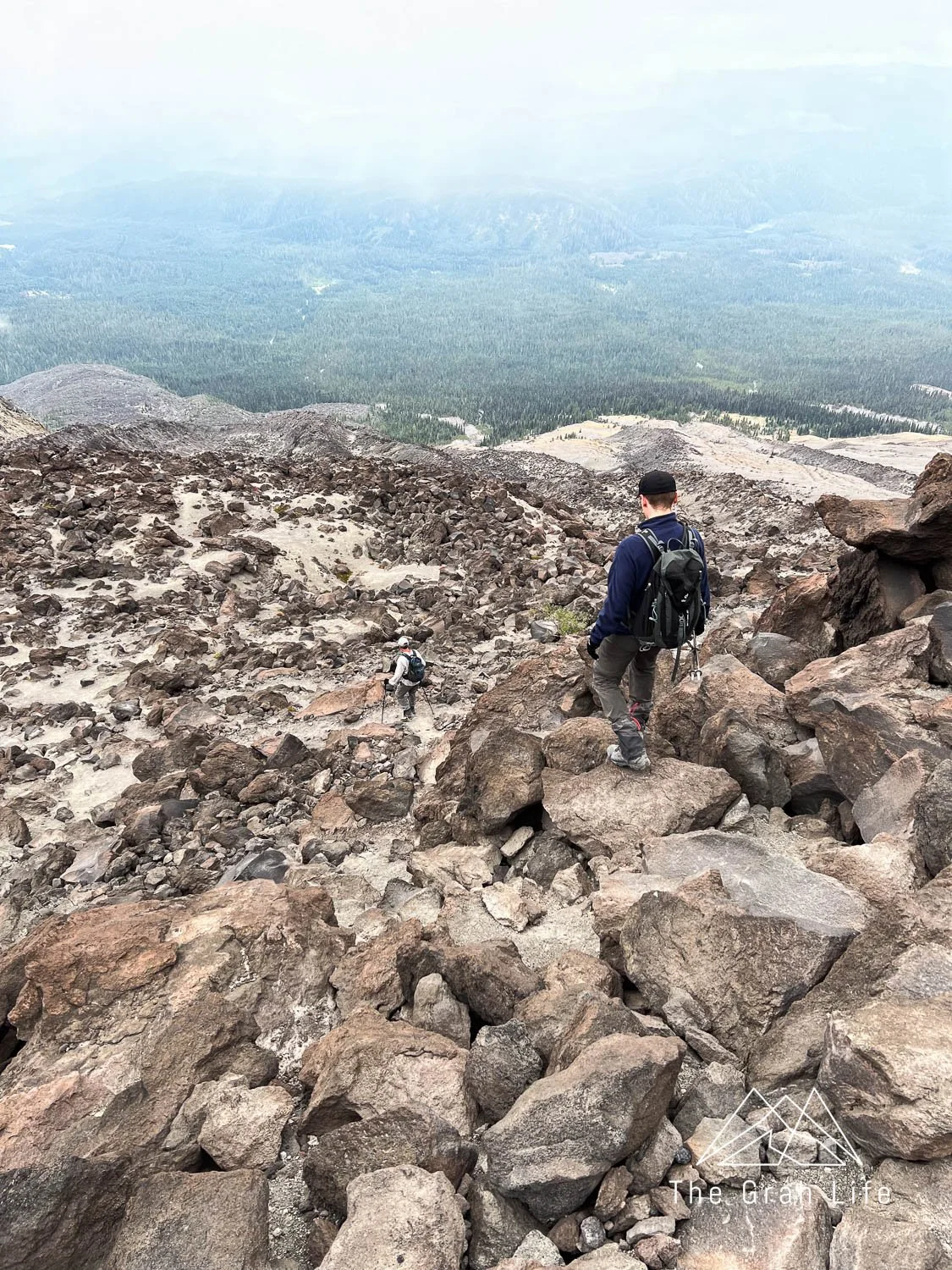
The boulder field
The boulder field is tiring because you’ll be walking around, climbing over, and generally taking unusual steps up and down it. To prepare for this, you’ll want to hike the steepest trails you can find. Not only because the boulder field is steep, but also because steep trails mimic some of the actions you’ll be making while climbing the boulders.
If you don’t already have trekking poles, get some. They are essential because they take weight off your knees and prevent injuries. They’ll take a hike or two to get used to, but if nothing else, use them on steep downhill sections.

The distance
The Ptarmigan trail is 10 miles roundtrip. Hike longer, steep trails to gain endurance. Hike at a pace you could keep up for miles. It’s much easier (mentally and physically) than a start-and-stop pace. If you’re hiking with a group, the slowest person should set the pace.
On the climb, your pack will be loaded with three liters of water, snacks, layers, the 10 essentials, and anything else you might need (check our packing list here), so you’ll be carrying a bit of weight. If you’d like to add extra weight to your pack on training hikes, put in a few extra water bottles. On the off chance you need to offload weight during your hike, pouring out the extra water is easy.

Route finding
Most of the climb up Mount St. Helens is done by route finding. The boulder field has no designated trail, so you’ll be choosing which paths to take guided by trail markers. If you’re unfamiliar with route finding, we recommend getting some practice in before your climb and have marked which training hikes include it.
When should you start training?
Ideally, start training three or more months before your climb. Start with easier hikes and work your way up to tackling steep elevation gains and longer distances. By the time it’s your time to climb, you should be able to hike 10 miles.
Aim to hike at least once a week up until your climb, and when that’s not possible, supplement hiking with other workouts. These workouts are important too! Focus on strengthening your ankles, knees, hips, and core muscles — these are the muscles your body will rely on when your legs tire. The more you work out and hike leading up to your climb, the more enjoyable it will be!

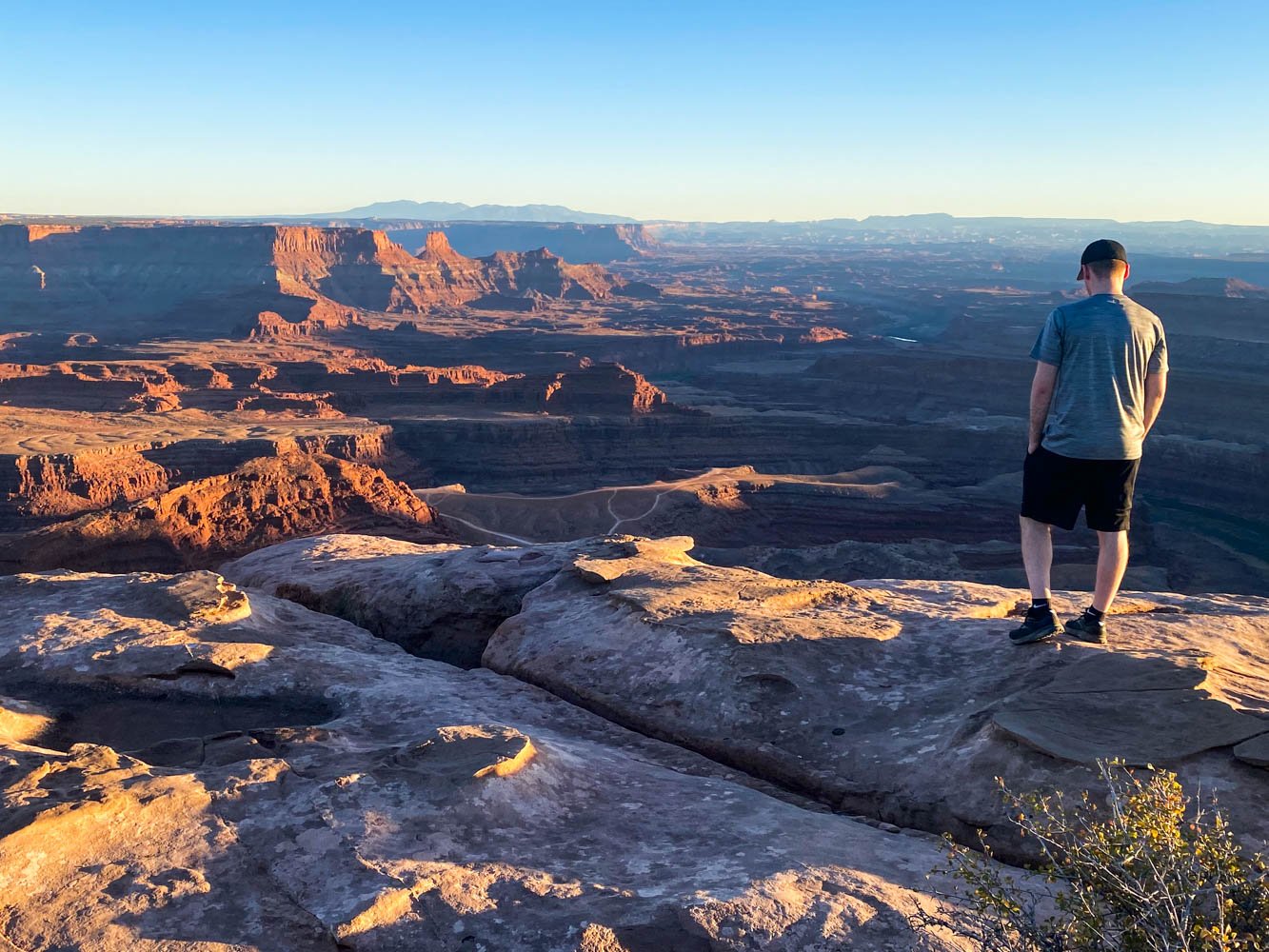
Tired, but happy smiles where we turned around in 2017

Big smiles and energy at the summit it 2023
Parking passes
Most trails in Washington require you to hang a parking pass on your windshield. There are three different passes and some overlap in coverage. Each vehicle that you have parked at a trailhead will need a pass. Most trailheads don’t have places to purchase passes, so get them beforehand at your local ranger station, REI, or online.
Discover Pass
The Discover Pass covers all of Washington’s state parks. They’re $12 for a day pass or $35 for the annual pass. This is the only pass that covers state parks.
America the Beautiful Pass
This pass covers parking in all U.S. national parks, but also national forest land in Oregon and Washington as well. This is the pass we use most often because it covers such a broad range of areas. It costs $80 for an annual pass.
You can also buy national park passes specific to the national park you’ll be visiting. This costs $30 for a seven-day pass or $55 for an annual pass, per park. These passes don’t provide national forest coverage, and since there are three national parks in Washington, the America the Beautiful Pass is a great investment.
National Forest Pass
The National Forest Pass is $10 for a day pass or $30 for the annual pass. They’re valid in Washington and Oregon and are required for so many hikes. If you plan on buying an America the Beautiful Pass, it covers national forest land too, so you don’t need both.
Training hikes
We’ve organized these hikes by length. Start with hikes (on this list or not) that are in your comfort level and work towards longer and steeper hikes. Don’t discount the hikes on this list that aren’t as long either — they are some of the steepest!
This list is a great place to start but browse wta.org and alltrails.com for hikes as well. With over 700 miles of trails in Washington, you’re bound to find inspiring options!
Plummer Peak
Trail description: Washington Trails/Alltrails
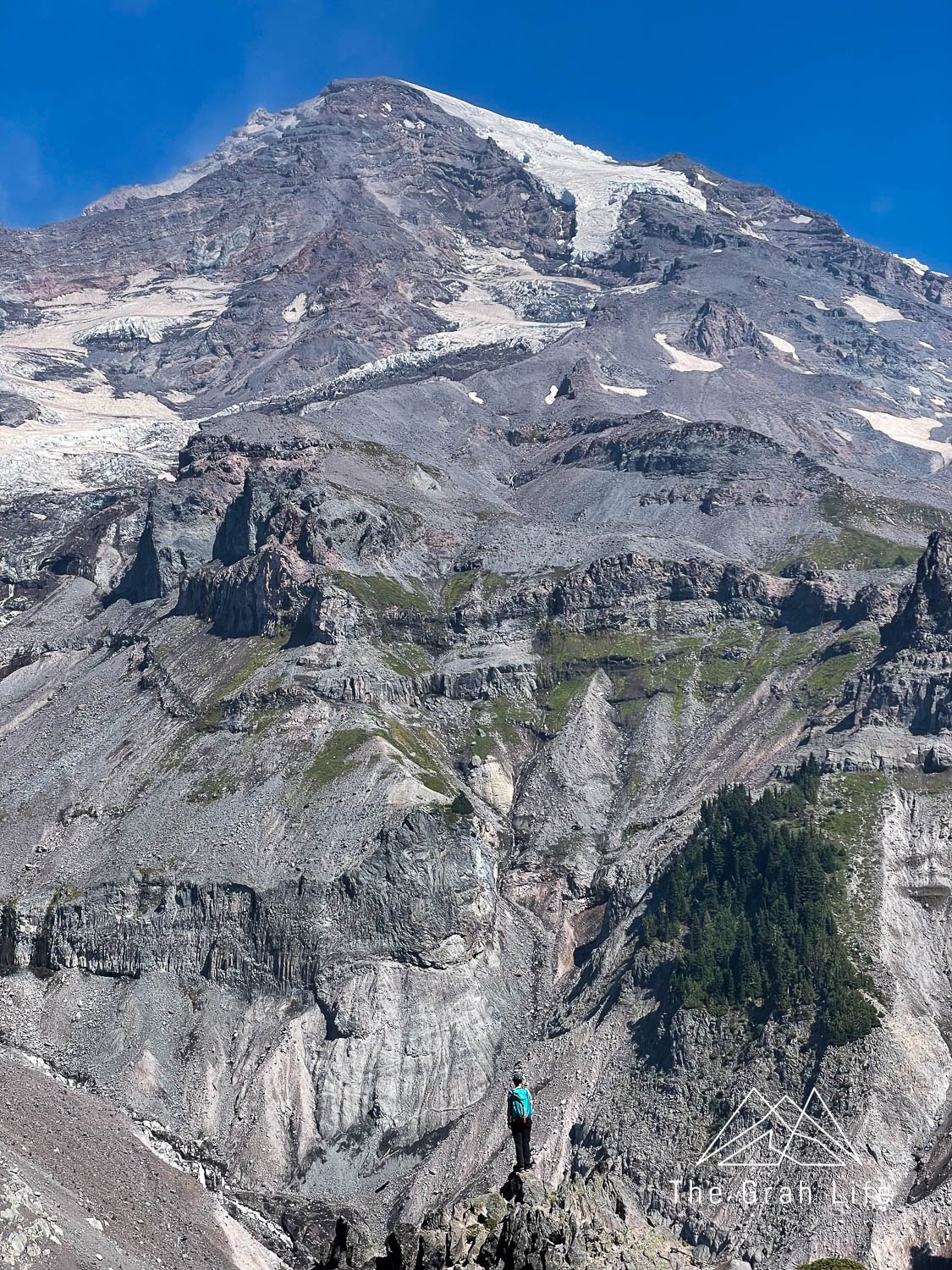
Location: Mount Rainier
Distance: 3.1 miles roundtrip
Elevation gain: 1,440 feet
Season: July to October
Parking Pass needed: Mount Rainier Entrance Fee or an America the Beautiful pass
Route finding: Yes, from Pinnacle Saddle to Plummer Peak
Dogs allowed on a leash: No

Mount Walker
Mount Walker has a 20% grade on average, and since it’s accessible year-round (microspikes are needed throughout winter), it makes for a great training hike. Find rhododendrons blooming in late May and June and views of the Olympics, British Columbia, and Mount Baker from the top.
Trail description: Washington Trails/Alltrails
Location: Olympic Peninsula
Distance: 4 miles roundtrip
Elevation gain: 2,000 feet
Season: Year round
Parking Pass needed: None
Route finding: No
Dogs allowed on a leash: Yes
Mount Storm King
This is one of our all-time favorite hikes. It’s a great workout with fantastic views of Lake Crescent. Fair warning though — it’s not recommended for those with a strong fear of heights. There is an unmaintained section of the trail to reach the final viewpoint. In this section, you’ll be using ropes to scramble up loose scree and dirt near the edge of a cliff. If ropes aren’t your thing, it’s possible to hike up until this point and turn around — you’ll have completed nearly all of the hike, seen some of the view, and gotten a great workout.
Trail description: Washington Trails/Alltrails
Location: Olympic Peninsula
Distance: 4 miles roundtrip
Elevation gain: 2,065 feet
Season: Year round
Parking Pass needed: None
Route finding: No
Dogs allowed on a leash: No

Mount Pilchuck
This trail is closed until 2024 for a much-needed road improvement project. When it opens, hikers can enjoy 360-degree views from the fire lookout at the top of the hike. It’s popular enough that we’d advise fitting this one in on a weeknight.
Trail description: Washington Trails/Alltrails
Location: Central Cascades
Distance: 5.4 miles roundtrip
Elevation gain: 2,300 feet
Season: July to October
Parking Pass needed: Northwest Forest Pass or an America the Beautiful pass
Route finding: Yes, there is a small scramble at the end of the hike
Dogs allowed on a leash: Yes
Dog Mountain
This hike is so popular in spring due to the abundance of wildflowers, a permit is required to hike here on weekends between March and June. Regardless of when you hike, the views of the Columbia River Gorge and Mount Hood are beautiful. It can be breezy at the top, so be prepared for a bit of wind.
Trail description: Washington Trails/Alltrails
Location: Olympic Peninsula
Distance: 6 miles roundtrip
Elevation gain: 2,800 feet
Season: March to November
Parking Pass needed: Northwest Forest Pass or an America the Beautiful pass
Route finding: No
Dogs allowed on a leash: Yes

Mount Ellinor
This hike has a lower and upper trailhead. Start at the lower lot to get a warmup before the steady incline or jump right into it at the upper trailhead. It’s famous for its stair climb, and this is a great place to practice the mental grit you’ll need for the climb through the ash at the top of Mount St. Helens.
Trail description: Washington Trails/Alltrails
Location: Olympic Peninsula
Distance: 6.2 / 3.2 roundtrip
Elevation gain: 3,300 / 2,444 feet
Season: June through October
Parking Pass needed: Northwest Forest Pass or an America the Beautiful pass
Route finding: No
Dogs allowed on a leash: Yes

Mildred Point
This hike is a classic! It’s beautiful, follows a river, has multiple waterfalls, and ends with a great view of Rainier. It’s a decent workout overall, but the last section of this hike is the steepest. If you’d like to make this hike longer, start at Longmire and begin your hike on the Wonderland Trail.
Trail description: Washington Trails/Alltrails
Location: Mount Rainier
Distance: 7 miles roundtrip
Elevation gain: 3,135 feet
Season: July to October
Parking Pass needed: Mount Rainier Entrance Fee or an America the Beautiful pass
Route finding: No
Dogs allowed on a leash: No
Poo Poo Point
Only 25 minutes from Seattle and accessible year-round, Poo Poo Point makes for a great hike after work during the summer months. It’s the perfect spot to watch the sunset, and in the summer, you’ll often see paragliders taking off and landing from the top, so stay off the turf to give them room. Make it longer by starting on this route.
Trail description: Washington Trails/Alltrails
Location: Central Cascades
Distance: 7.2 miles roundtrip
Elevation gain: 1,748 feet
Season: Year round
Parking Pass needed: None
Route finding: No
Dogs allowed on a leash: Yes
Mailbox Peak
Go up the old trail and down the new trail for the steepest ascent and longer, safer descent. Although this one is accessible year-round, the weather can vary greatly in the winter. In winter, be prepared for snow and windy conditions at the top. On a clear day, you’ll have a view of Rainier. Don’t forget to bring something fun to put in the Mailbox and grab an item from it before you go!
Trail description: Washington Trails/Alltrails
Location: Central Cascades
Distance: 7.4 roundtrip
Elevation gain: 4,000 feet
Season: Year round
Parking Pass needed: Discover Pass
Route finding: Yes, on the old trail only
Dogs allowed on a leash: Yes

Hamilton Mountain
This hike is worth the trek, training or not! You’ll find Rodney Falls one mile into the hike, followed by beautiful forests, wildflowers, and views of the Columbia River Gorge. Once you reach the top, keep following the trail to make this hike a loop. It’s 1.5 miles longer, but you’ll be the only ones on the trail!
Trail description: Washington Trails/Alltrails
Location: Columbia River Gorge
Distance: 7.5 roundtrip
Elevation gain: 2,000 feet
Season: Year round
Parking Pass needed: Discover Pass
Route finding: No
Dogs allowed on a leash: Yes

Mount Townsend
This entire trail has gorgeous views. On your way to the summit, ogle waterfalls, wildflowers, and mountain views. Once you’re at the top of the hike, be prepared for a chance of wind. Go on a clear day to have the best views of the surrounding peaks.
Trail description: Washington Trails/Alltrails
Location: Olympic Peninsula
Distance: 8 roundtrip
Elevation gain: 3,010 feet
Season: July to October
Parking Pass needed: None
Route finding: No
Dogs allowed on a leash: Yes
Shriner Peak
This trail is surprisingly overlooked! Washington Trails Association calls it Washington’s loneliest fire lookout, and it’s true you won’t see many other hikers here. Instead, you’ll find beautiful wildflowers, close-up views of Mount Rainier, and a fire lookout. This trail is completely exposed, so hike here on an overcast day. It’s slightly more difficult than Mt Si, which is a great alternative if you’d like to hike in the winter months.
Trail description: Washington Trails/Alltrails
Location: Mount Rainier
Distance: 8.5 roundtrip
Elevation gain: 3,434 feet
Season: June to September
Parking Pass needed: None
Route finding: No
Dogs allowed on a leash: No

Granite Mountain
You’ll earn your views with this one! The steep climb will reward you with mountain views and huckleberries in the late summer. The last section is exposed, so bring a hat and sunscreen.
Trail description: Washington Trails/Alltrails
Location: Central Cascades
Distance: 8.6 roundtrip
Elevation gain: 3,800 feet
Season: June to October
Parking Pass needed: Northwest Forest Pass or an America the Beautiful pass
Route finding: No
Dogs allowed on leash: Yes
Lake Ingalls
This hike has wildflowers, a lake, and larches so it’s no wonder it’s popular. The parking lot is rather small so arrive early to find a spot.
Trail description: Washington Trails/Alltrails
Location: Central Cascades
Distance: 9 roundtrip
Elevation gain: 2,500 feet
Season: July to October
Parking Pass needed: Northwest Forest Pass or an America the Beautiful pass
Route finding: No
Dogs allowed on leash: No
Gothic Basin
We have yet to hike this trail, but it looks like a solid contender for this list. Since there is a lake at the top of this hike, I’d advise hiking here early or late in the season to avoid the most mosquitos!
Trail description: Washington Trails/Alltrails
Location: Central Cascades
Distance: 9.2 roundtrip
Elevation gain: 2,840 feet
Season: June through October
Parking Pass needed: Northwest Forest Pass or an America the Beautiful pass
Route finding: No
Dogs allowed on a leash: Yes
Sourdough Mountain
This hike is steep and a great trail to work up to. It’s slightly longer and steeper than the Ptarmigan Trail on Mount St. Helens so it’s a great one to try out a week or two before your climb!
Trail description: Washington Trails/Alltrails
Location: North Cascades
Distance: 10.4 roundtrip
Elevation gain: 4,870 feet
Season: June through October
Parking Pass needed: Northwest Forest Pass or an America the Beautiful pass
Route finding: No
Dogs allowed on a leash: No
Navaho Pass
Navaho Pass is one of our all-time favorite hikes. It’s so beautiful and has a wide variety of scenery throughout. Make it longer by route finding your way to Navaho Peak.
Trail description: Washington Trails/Alltrails
Location: Central Cascades
Distance: 11 roundtrip
Elevation gain: 3,000 feet
Season: June through October
Parking Pass needed: Northwest Forest Pass or an America the Beautiful pass
Route finding: No
Dogs allowed on a leash: Yes


Search the blog for more adventures! Try searching for topics such as “mountains”, “road trip”, or “Mount Rainier”.