Mount St. Helens Activities
Mount St. Helens is an incredible, and dare we say, underrated area. The volcano has erupted more frequently than any other volcano in the Cascade Range – most recently in 1980 when the blast and record-breaking landslide drastically changed the landscape. Over the years, the landscape has come back to life. Now, you can relive the eruption at visitor centers, view active seismographs, climb the mountain, and laze about rivers in the area.
There is so much to do and see, so we split this blog into geographic regions. Spend a weekend exploring it all or make a few day trips to see everything the mountain has to offer.
Know where you want to explore? Click the link below to jump to that area.
Northeast
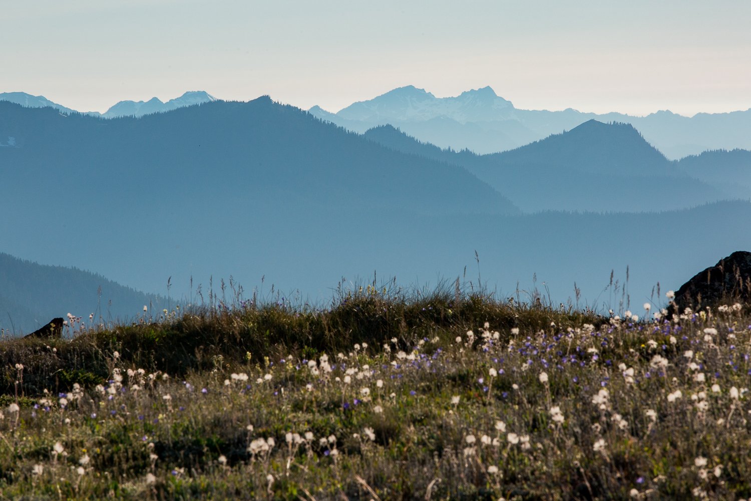
If you’re visiting Mount St. Helens for the first time, spending the day driving up Highway 504 is a great way to see the mountain. You’ll get to see the heart of the blast zone — the area where the pyroclastic flow (a massive avalanche of debris) from Mount St. Helen’s 1980 eruption knocked down trees for 19 miles and gaze into the crater from a distance. If you’ve seen it before, it’s worth revisiting to see how life is coming back to the area!
Visitor Centers
Mt St Helens Visitor Center
Once you exit I-5 in Castle Rock, this will be the first place you should stop. The visitor center sits on Silver Lake and features interactive exhibits, a step-in model of the volcano, a functioning seismograph, and a live feed of current activity (the crater smokes sometimes!).
Do be sure to walk the 0.6-mile-long trail around Silver Lake. It has beautiful boardwalks that go over the lake and is a great place to birdwatch, all in sight of Mount St. Helens on a clear day.
The visitor center is a Washington State Park (Discover Pass not required), and there is an entry fee of $5 per adult. They’re open daily but closed on national holidays.
Forest Learning Center
Free to the public and open between May 18th to October 1st, this visitor center is operated by Weyerhaeuser, one of the largest sustainable forest product companies in the world.
Visit to hear the story of Mount St. Helens through the “Eruption Chamber”, where you’ll see and hear the eruption and news footage from eyewitness accounts.
Before you leave, check out the wildlife viewing area — elk frequent here!
Johnston Ridge Observatory
Note: The Johnston Ridge Observatory is closed due to a landslide as of 6/8/23, but usually it’s open seasonally. It will be closed through 2027 while bridge and road repairs take place. Check for updates here.
This observatory is in the heart of the blast zone. Visit and you’ll find great views of Mount St. Helens, the crater, and have access to many trails.
Bring your America the Beautiful Pass to cover entry fees for up to four people or pay $8 per person.
On your way from Castle Rock to the Johnston Ridge Observatory, listen to this audio tour made by the Cowlitz County Historical Museum.

View from the Johnston Ridge Observatory in 2001
Paddle
Based along the Toutle River, Rapid Rides Adventure offers seasonal white water rafting tours as well as tube and kayak rentals (wetsuit rentals are available, too!). The float downriver (by kayak or tube) will take 1.5 to 2.5 hours depending on water flows, and you can catch a ride back to the starting point with their free shuttle.
If you’d rather paddle around a lake, rent paddle boards or kayaks from the Silver Lake Resort or Streeter’s Resort on Silver Lake. If you have your own kayaks or paddle boards, Coldwater Lake is another great place to put in.
Hike
The northeast side of Mount St. Helens has some fantastic hikes. Thanks to the eruption, each trail is significantly different.

Meghann’s family on a trail near the Johnston Ridge Observatory in 2001. Meghann is the one lagging behind on the hike, per usual.
Bike
Every year in June, the Tour de Blast bike ride takes place on Highway 504. Bikers start their ride in Toutle and choose between beginner and advanced levels of rides, with the opportunity to bike up 6,430 feet of elevation to the Johnston Ridge Viewpoint.
Where to stay
The Eco Park Resort, Streeter’s Resort and Silver Lake RV Resort all offer cabins, RV sites, and tent sites. If you’re looking to tent camp or RV, check out the Kid Valley Campground and Seaquest State Park as well.
Where to eat
The Fire Mountain Grill is the only restaurant on Highway 504. It’s worth a stop to try their berry pie or huckleberry ice cream!
Northwest
Although Highway 12 is accessible year-round, Northwest Forest Road 25 — the road that goes up to Windy Ridge and many of the hikes mentioned below is only accessible between late June and November. If you make it out this way, you can enjoy camping and hiking.
Windy Ridge Interpretive Site
Take an offshoot from the main forest road and you’ll find yourself five miles from Mount St. Helens. From here you’ll have a beautiful panoramic view from above Spirit Lake. Find the best views up 368 sandy stairs. Along the route, be sure to stop at the Miners Car to see the remains of a Pontiac Grand Prix from the 1980 eruption.
Bring your America the Beautiful Pass, a Northwest Forest Pass, or pay $5 onsite to visit.

View from the Windy Ridge Interpretive Site in 2001
Hike
There are so many hikes in this area on our bucket list! So far, our favorites are Camp Creek Falls, Layser Cave, and Cathedral Falls.
Paddle
Taidnapam Park is a great spot to put in kayaks and paddleboards. Since it is a reservoir, check the lake levels before heading out.
Where to stay
The best place to camp (RV or tent) in the area is at Taidnapam Park near Morton. If you’re looking for lodging, we recommend staying at Hotel Packwood, an adorable renovated historic hotel.
Where to eat
Try the Huff ‘N’ Puff drive-in at Randle, or if you are headed to Packwood, stop at Cliff Droppers or the Packwood Brewing Co.
Southeast
This area is best known for its impressive lava canyons, caves, and trail to climb Mount St. Helens. Since the 1980 eruption blew northward, this side of the mountain remains intact. You’ll see views of the volcano and forests throughout the area.

Views along Highway 504
Lelooska Foundation
On your way up to the mountain, stop by the Lelooska Foundation for information on tribes of the northwest coast. They have special events throughout summer and hold classes on weaving, creating beaded earrings, and more. In the spring reserve a ticket for their living history performance, just bring a coat — it’s held in the evenings outside!
Ape Caves
This is one of the few hikes we’ve repeated — it’s that fun! Since half the hike is in the cave and it stays 42 degrees inside, it’s the perfect adventure for most times of the year.
You can expect to spend about 2 to 3 hours scrambling over rocks while making your way through the cave. Be forewarned — at 0.8 miles into the cave there is an 8-foot wall, usually equipped with a rope, that you must scramble up.
After wandering 1.4 miles through the cave, you’ll find a ladder leading to a skylight exit. Wander past it if you’d like to see where the cave ends 500 feet later. After exiting the skylight, you’ll find yourself on a path that leads back to the start.
This trek is unusual, so there are a few things to know.
Do not touch the cave walls or ceilings. Tiny creatures feed on the cave slime and touching it kills their food.
Bring a headlamp and extra batteries.
You’ll want a headlamp for every person in your group. You’ll be using your hands to climb parts of this hike, so headlamps work better than flashlights.
Bring warm layers. Dress for 42 degrees, but know that you might work up a sweat, so bring clothing that can be taken on and off easily.
Bring a hat — it will not only protect your head if you bump it on the cave ceiling but also keep you dry since the cave drips.
The creatures that live in this cave are fragile. Please leave pets and food at home and refrain from smoking in the cave.
Hike
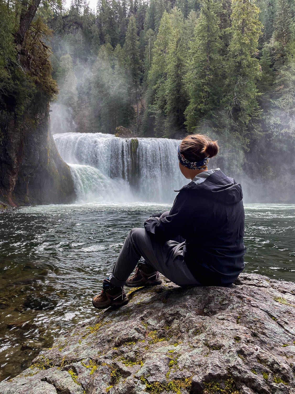
There are a good number of hikes to explore in this region. So far our favorites are the Lava River Canyon and Lower Lewis River Falls, but consider the following as well:

Lower Lewis Falls
Climb
You can summit Mount St. Helens! Between July and September, the climb is non-technical so if you’re up for a long, steep climb, and can snag a permit you can peer into the crater from the top of the mountain. There’s a lot to know about the climb, so read our guide on how to climb Mount St. Helens before making any plans.

Where to stay
Cougar, WA is the closest town on the south side of Mount St. Helens. We’ve enjoyed staying in the cabins at the Lone Fir Resort, and they offer RV and tent sites as well. You’ll find more RV and tent camping at the Cougar RV Park and Campground as well as the Cougar Park Campground (tent only).
Where to eat
Cougar Washington has very few, but very yummy restaurant options. The Lone Fir Café has the best food in the area, but if you’re in the area on a Saturday evening stop by the Cougar Bar and Grill for prime rib.
Leave no trace
Wherever you choose to explore, please follow the leave no trace principles by staying on trails, packing out anything you take in, and respecting the wildlife and other visitors. This helps keep our public land beautiful, safe, and accessible!


Search the blog for more adventures! Try searching for topics such as “mountains”, “road trip”, or “Mount Rainier”.