How to Train to Thru-Hike the Enchantments
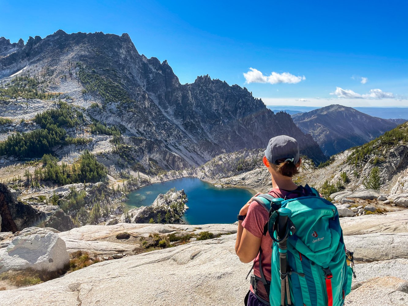
As beautiful as the Enchantments are, thru-hiking here shouldn’t be done on a whim. It’s a grueling 18-mile trek, best done with preparation and training. It’s as rewarding as it is difficult, and along the way, you’ll be treated to some of Washington’s finest alpine lakes and rugged mountains.
If you haven’t already, read this blog to find out everything you need to know about the trail.
Click here to skip to the hike recommendations.
Thru-hike details
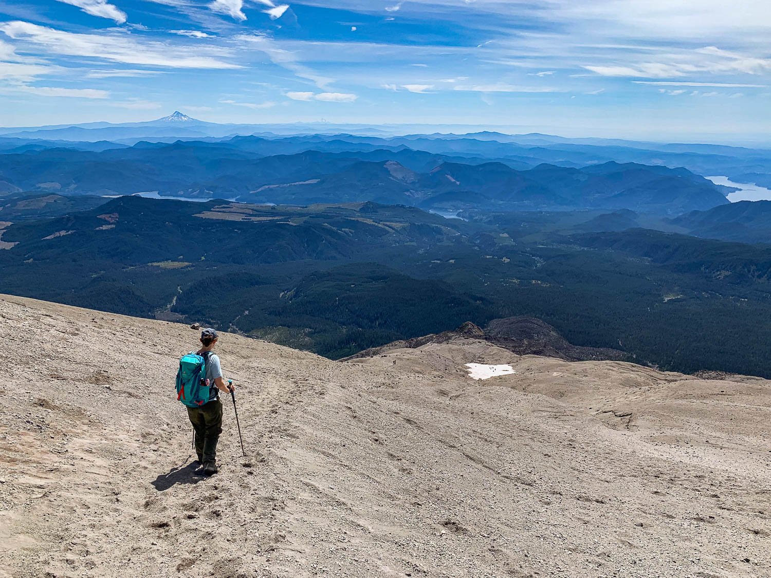
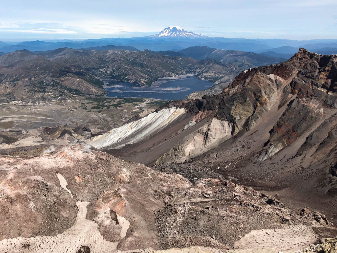
When deciding on thru-hiking the Enchantments for the first time, two things intimidated us – how steep Aasgard Pass is and the total distance of the hike. At the time, the most we’d hiked in a day was 12 miles — summiting Mount St. Helens — and the Enchantments thru-hike is nearly twice the distance with more elevation gain and loss.
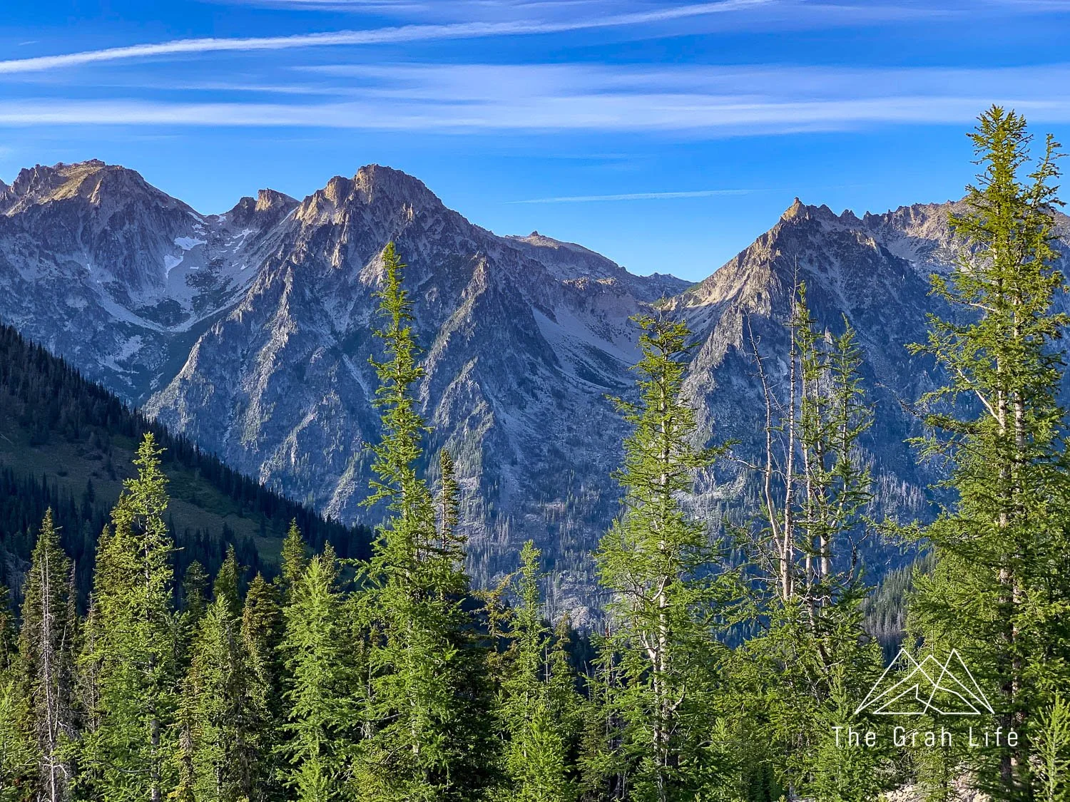
Aasgard Pass
Here’s what you need to know about Aasgard Pass: The pass is only three-quarters of a mile long, but you’ll be gaining 2,000 feet of elevation on it. To put that in perspective, that would be like cramming all of Poo Poo Point’s elevation gain into one mile of the trail. To prepare for this, we hiked the steepest trails we could find.

The distance
To gain endurance and muscle, we hiked longer, harder trails. Our goal was to hike once a week between May and September. Of course, this wasn’t always feasible, so there were times we supplemented hiking with 20 minutes of stair climbing (work up to this) and weightlifting at the gym up to four times a week.
Focus on more than just gaining muscle in your legs while you’re at the gym. When your legs tire on your thru-hike, your body will rely on your hips, ankles, and core muscles to get you through to the end, so your time spent in the gym will be as beneficial as each training hike.
Route finding
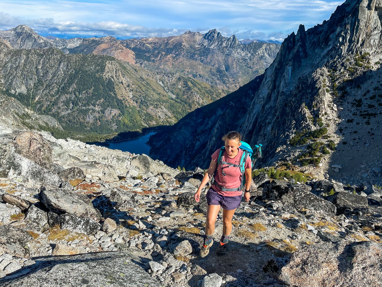
If you’re unfamiliar with route finding, we recommend getting some practice in before tackling the Enchantments. The thru-hike has no designated trail between the start of Aasgard Pass through the Core Zone (six miles). In these areas, you’ll be choosing the best routes to take over rocks and scree, while guided by cairns periodically, instead of following a clear path like most hikes in Washington have. Choosing your route well will save you energy, time, and strength.

The Core Zone of the Enchantments
Parking passes
Most trails in Washington require you to hang a parking pass on your windshield. There are three different passes and some overlap in coverage. Each vehicle that you have parked at a trailhead will need a pass. Most trailheads don’t have places to purchase passes, so get them beforehand at your local REI, ranger station, or online.
Discover Pass
The Discover Pass covers all of Washington’s state parks. They’re $12 for a day pass or $35 for the annual pass. This is the only pass that covers state parks.
America the Beautiful Pass
This pass covers parking in all U.S. national parks, but also national forest land in Oregon and Washington as well. This is the pass we use most often because it covers such a broad range of areas. It costs $80 for an annual pass.
You can also buy national park passes specific to the national park you’ll be visiting. This costs $30 for a seven-day pass or $55 for an annual pass, per park. These passes don’t provide national forest coverage, and since there are three national parks in Washington, the America the Beautiful Pass is a great investment.
National Forest Pass
The National Forest Pass is $10 for a day pass or $30 for the annual pass. They’re valid in Washington and Oregon and are required for so many hikes. If you plan on buying an America the Beautiful Pass, it covers national forest land too, so you don’t need both.
Training hikes
Overall, the more mileage you can log before your thru-hike, the better you’ll feel during it! We’ve organized our hike recommendations by distance, but don’t discount the shorter hikes — they are some of the steepest.
Plummer Peak
Trail description: Washington Trails/Alltrails
Location: Mount Rainier
Distance: 3.1 miles roundtrip
Elevation gain: 1,440 feet
Season: July to October
Parking Pass needed: Mount Rainier Entrance Fee or an America the Beautiful pass
Route finding: Yes, from Pinnacle Saddle to Plummer Peak
Dogs allowed on a leash: No

Mount Storm King
This is one of our all-time favorite hikes. It’s a great workout with fantastic views of Lake Crescent. Fair warning though — it’s not recommended for those with a strong fear of heights or vertigo. There is an unmaintained section of the trail to reach the final viewpoint. In this section, you’ll be using ropes to scramble up loose scree and dirt near the edge of a cliff. If ropes aren’t your thing, it’s possible to hike up until this point and turn around — you’ll still have completed most of the hike, seen part of the view, and gotten a great workout.
Trail description: Washington Trails/Alltrails
Location: Olympic Peninsula
Distance: 4 miles roundtrip
Elevation gain: 2,065 feet
Season: Year round
Parking Pass needed: None
Route finding: No
Dogs allowed on a leash: No

Dog Mountain
This hike is so popular in spring due to the abundance of wildflowers, a permit is required to hike here on weekends between March and June. Regardless of when you hike, it’s a fantastic workout. It can be breezy at the top, so be prepared for a bit of wind.
Trail description: Washington Trails/Alltrails
Location: Olympic Peninsula
Distance: 6 miles roundtrip
Elevation gain: 2,800 feet
Season: March to November
Parking Pass needed: Northwest Forest Pass or an America the Beautiful pass
Route finding: No
Dogs allowed on a leash: Yes


Mount Ellinor
This hike has a lower and upper trailhead. Start at the lower lot to get a warmup before the steady incline or jump right into it at the upper trailhead. It’s famous for its stair climb, and this is a great place to practice finding a slow and steady pace as you’ll need for Aasgard Pass.
Trail description: Washington Trails/Alltrails
Location: Olympic Peninsula
Distance: 6.2 / 3.2 roundtrip
Elevation gain: 3,300 / 2,444 feet
Season: June through October
Parking Pass needed: Northwest Forest Pass or an America the Beautiful pass
Route finding: No
Dogs allowed on a leash: Yes

Mildred Point
This hike is a classic! It’s beautiful, follows a river, has multiple waterfalls, and ends with a great view of Rainier. It’s a decent workout overall, but the last section of this hike is the steepest. If you’d like to make this hike longer, start at Longmire and begin your hike on the Wonderland Trail.
Trail description: Washington Trails/Alltrails
Location: Mount Rainier
Distance: 7 miles roundtrip
Elevation gain: 3,135 feet
Season: July to October
Parking Pass needed: Mount Rainier Entrance Fee or an America the Beautiful pass
Route finding: No
Dogs allowed on a leash: No

Poo Poo Point
Only 25 minutes from Seattle and accessible year-round, Poo Poo Point makes for a great hike after work during the summer months. It’s the perfect spot to watch the sunset, and in the summer, you’ll often see paragliders taking off and landing from the top, so stay off the turf to give them room. Make it longer by starting on this route.
Trail description: Washington Trails/Alltrails
Location: Central Cascades
Distance: 7.2 miles roundtrip
Elevation gain: 1,748 feet
Season: Year round
Parking Pass needed: None
Route finding: No
Dogs allowed on a leash: Yes
Mailbox Peak
Go up the old trail and down the new trail for the steepest ascent and longer, safer descent. Although this one is accessible year-round, the weather can vary greatly in the winter. In winter, be prepared for snow and windy conditions at the top. On a clear day, you’ll have a view of Rainier. Don’t forget to bring something fun to put in the Mailbox and grab an item from it before you go!
Trail description: Washington Trails/Alltrails
Location: Central CascadesDistance: 7.4 roundtrip
Elevation gain: 4,000 feet
Season: Year round
Parking Pass needed: Discover Pass
Route finding: Yes, on the old trail only
Dogs allowed on a leash: Yes

Shriner Peak
This trail is surprisingly overlooked! Washington Trails Association calls it Washington’s loneliest fire lookout, and it’s true you won’t see many other hikers here. Instead, you’ll find beautiful wildflowers, close-up views of Mount Rainier, and a fire lookout. This trail is completely exposed, so hike here on an overcast day. It’s slightly more difficult than Mt Si, which is a great alternative if you’d like to hike in the winter months.
Trail description: Washington Trails/Alltrails
Location: Mount Rainier
Distance: 8.5 roundtrip
Elevation gain: 3,434 feet
Season: June to September
Parking Pass needed: None
Route finding: No
Dogs allowed on a leash: No

Granite Mountain
You’ll earn your views with this one! The steep climb will reward you with mountain views and huckleberries in the late summer. The last section is exposed, so bring a hat and sunscreen.
Trail description: Washington Trails/Alltrails
Location: Central Cascades
Distance: 8.6 roundtrip
Elevation gain: 3,800 feet
Season: June to October
Parking Pass needed: Northwest Forest Pass or an America the Beautiful pass
Route finding: No
Dogs allowed on leash: Yes
Third Burroughs
You’ll have great views of Mount Rainier for this entire hike, but it’s completely exposed. Start early to beat the heat and bring sun protection. Add 1.4 to your total mileage by starting this hike on the south side of the Sunrise parking lot, passing by Shadow Lake, a scenic overlook and part of the Wonderland Trail. It’s worth the detour.
Trail description: Washington Trails/Alltrails
Location: Mount Rainier
Distance: 9 roundtrip
Elevation gain: 2,500 feet
Season: Late May to October
Parking Pass needed: Mount Rainier Entrance Fee or an America the Beautiful pass
Route finding: No
Dogs allowed on a leash: No

Gothic Basin
We have yet to hike this trail, but it looks like a solid contender for this list. Since there is a lake at the top of this hike, I’d advise hiking here early or late in the season to avoid the most mosquitos!
Trail description: Washington Trails/Alltrails
Location: Central Cascades
Distance: 9.2 roundtrip
Elevation gain: 2,840 feet
Season: June through October
Parking Pass needed: Northwest Forest Pass or an America the Beautiful pass
Route finding: No
Dogs allowed on a leash: Yes
Mount Si via Mount Teneriffe Trail
This is a great trail to log a longer distance early in the year. We hiked this trail in late winter and only saw a few others. It’s not especially scenic, you’ll be hiking in the forest until you reach Mt Si, but it is quiet.
Trail description: Washington Trails/Alltrails
Location: Central Cascades
Distance: 10 miles roundtrip
Elevation gain: 2,950 feet
Season: Year round
Parking Pass needed: Northwest Forest Pass or an America the Beautiful pass
Route finding: No
Dogs allowed on a leash: Yes
Mount St. Helens - Monitor Ridge (by permit only)
If you’ve managed to snag permits (now released one month in advance) then this will make a fantastic training hike! Most of the hike up this active volcano is picking your way through boulders up to the last section of trail made up of ash. There’s a lot more you need to know about this trail, so check here for more information.
Trail description: Washington Trails/Alltrails
Location: Mount St. Helens
Distance: 10 miles roundtrip
Elevation gain: 4,500 feet
Season: June through September
Parking Pass needed: Northwest Forest Pass or an America the Beautiful pass
Route finding: Yes
Dogs allowed on a leash: No

Mount Defiance
Be forewarned: this is not a tranquil hike. Noise pollution from interstate 90 can be heard the entire hike, but once you reach the summit, you’ll see layers upon layers of the Cascade mountains. Look east and you can even see the tips of the peaks in the Enchantments!
Trail description: Washington Trails/Alltrails
Location: Central Cascades
Distance: 11 miles roundtrip
Elevation gain: 3,584 feet
Season: June through October
Parking Pass needed: Northwest Forest Pass or an America the Beautiful pass
Route finding: Yes
Dogs allowed on a leash: Yes
Kendall Katwalk
Here, you’ll get to hike part of the infamous Pacific Crest Trail. This section of the trail is named for the part of the trail that was blasted out of a steep rock face. What’s left is the “Katwalk” — a narrow path. You’ll know when you’ve reached it. Take a lunch break on boulders just past the Katwalk, overlooking the valley. From there keep trekking towards Canada as long as you like, or make this your turnaround point.
Trail description: Washington Trails/Alltrails
Location: Central Cascades
Distance: 12 miles roundtrip
Elevation gain: 2,600 feet
Season: July through October
Parking Pass needed: Northwest Forest Pass or an America the Beautiful pass
Route finding: No
Dogs allowed on a leash: Yes

Navaho Peak
Meghann especially loves this hike. When we hiked this trail, it had a larger variety of wildflowers than we’d seen the entire summer, and it has four distinct landscapes so you’ll never be bored of your surroundings. Once you reach Navaho Pass, head to the right to make your way to the summit and enjoy views of Mount Stuart the entire climb.
Trail description: Washington Trails/Alltrails
Location: Central Cascades
Distance: 13.7 roundtrip
Elevation gain: 4,223 feet
Season: June through October
Parking Pass needed: Northwest Forest Pass or an America the Beautiful pass
Route finding: Yes, on the last stretch to the summit
Dogs allowed on a leash: Yes
Mount Buckhorn
You’ll hike in the forest for the first half of this trail, then in exposed meadows, so be sure to bring sun protection. Once you’re out in the open, you’ll have great views of the surrounding Olympic mountains. Parking at the trailhead is tight, so start early.
Trail description: Washington Trails/Alltrails
Location: Olympic Peninsula
Distance: 13.5 miles roundtrip
Elevation gain: 4,477 feet
Season: July through October
Parking Pass needed: Northwest Forest Pass or an America the Beautiful pass
Route finding: No
Dogs allowed on a leash: Yes, but the trail to the summit has rough rocks

This should be a good list of hikes to get you started but browse wta.org and their trail finder app as well. Washington has over 700 miles of trails so you’re sure to find great options that are convenient and inspiring to you.
Did we miss any great training hikes? Let us know what trails you’re training on in the comments!


Search the blog for more adventures! Try searching for topics such as “mountains”, “road trip”, or “Washington”.